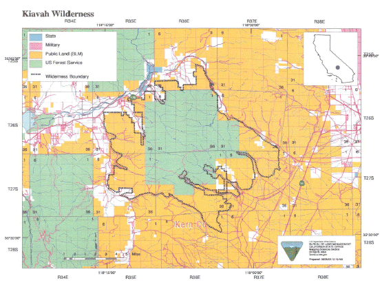
Digital-Desert : Mojave Desert
Intro:: Nature:: Map:: Parks:: Points of Interest:: Ghosts & Gold:: Communities:: Roads & Trails:: People & History:: BLOG:: Weather:: :?:: glossary

Wilderness - MAP
Kiavah >> Map #45

Kiavah Wilderness

SIZE: 88,290 acres

LOCATION: Kern County; 15 miles west of Ridgecrest, California

ACCESS: Access this wilderness from the north via Kelso Valley Road from State Highway 178 west of Inyokern; and from the east via State Highway 14 and numerous routes into Cow Heaven Canyon (SC5 1), Sage Canyon (SC56) and Horse Canyon (SC65), which are four-wheel drive only, and Bird Spring Pass Road (SC120).

Intro:: Nature:: Map:: Parks:: Points of Interest:: Ghosts & Gold:: Communities:: Roads & Trails:: People & History:: BLOG:: Weather:: :?:: glossary
Digital-Desert : Mojave Desert
Country Life Realty
Wrightwood, Ca.
Mountain Hardware
Wrightwood, Ca.
Canyon Cartography
G.A. Mercantile


Grizzly Cafe
Family Dining


Abraxas Engineering
privacy

Disclaimer: Some portions of this project were developed with assistance from AI tools to help reconstruct historical contexts and fill informational gaps. All materials have been reviewed and fact-checked to ensure accuracy and reliability, though complete precision cannot be guaranteed. The aim is to provide dependable starting points and distinctive perspectives for further study, exploration, and research.

These materials are historical in nature and intended for educational use only; they are not designed as travel guides or planning resources.
Copyright - Walter Feller. 1995-2025. All rights reserved.