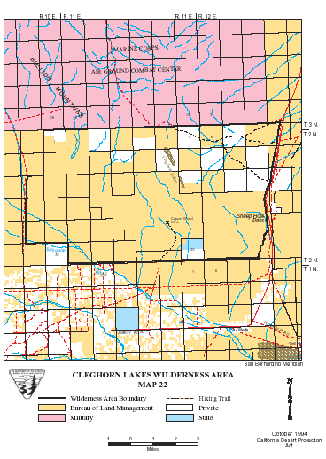
Cleghorn Lakes >> Map #22
Cleghorn Lakes Wilderness
SIZE: 33,980 acres
LOCATION: San Bernardino County; 16 miles northeast of Twentynine Palms, California
NATURAL RESOURCES: Named for the dry lakes found near its center, this wilderness contains vastly different natural resources. The east portion is mountainous while the west portion is a vast alluvial slope or bajada. Elevations range from 1,400 feet at the desert floor to the rugged Bullion Mountains, which rise more than 4,100 feet across a 4-mile stretch. The Bullion Mountains include desert bighorn sheep habitat, and desert tortoise can be found on the valley floor. Barrel cactus "gardens" and "smoke trees" inhabit some washes. The Lakes offer occasional spring wildflower displays, and Crucifixion Thorn has been found near the eastern edge of the wilderness boundary.
| GLOSSARY | > alluvial fan, bajada, dry lake |
ACCESS: Access this wilderness via Amboy Road from either Interstate 40 or State Highway 62.
Geomorphic Province : Mojave Desert
Ecosection : Mojave Desert
Ecosubsection : Bullion Mountains - Bristol Lake
Native Culture : Serrano (Vanyume), Chemehuevi, Cahuilla