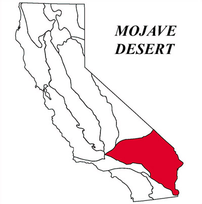
Mojave Desert Geomorphic Province
The Mojave is a broad interior region of isolated mountain ranges separated by expanses of desert plains. It has an interior enclosed drainage and many playas. There are two important fault trends that control topography a prominent NW-SE trend and a secondary east-west trend (apparent alignment with Transverse Ranges is significant). The Mojave province is wedged in a sharp angle between the Garlock Fault (southern boundary Sierra Nevada) and the San Andreas Fault, where it bends east from its northwest trend. The northern boundary of the Mojave is separated from the prominent Basin and Range by the eastern extension of the Garlock Fault.
List of Faults & Fault Zones
Sierra Nevada Fault ZoneAirport Lake Fault Zone
Little Lake Fault Zone
Wilson Canyon Fault
Tank Canyon
-
Garlock Fault Zone
- El Paso Fault
- Mule Spring and Leach Lake Faults
Owl Lake Fault
Granite Mountains Fault Zone
Avawatz Mountains Fault Zone
Soda Mountain Fault
Baker Fault
Red Pass Lake Fault
Tiefort Mountains Fault Zone
Goldstone Fault
Blackwater Fault
Bitter Springs Fault
- Bicycle Lake Fault
Gravel Hills - Harper Fault Zone
Harper Lake Fault
Lockhart and North Lockhart Faults
- South Lockhart Fault
Mt. General Fault
Calico Fault Zone
- Calico Fault
- West Calico Fault
Manix Fault
Cady Fault
Ludlow Fault
South Bristol Mountains Fault
Broadwell Lake Fault
Lavic Lake Fault
Pisgah Fault
Rodman Fault
Camp Rock Fault
Lenwood Fault
Helendale Fault
Kramer Junction Area Faults
- Kramer Hills Fault
- Spring Fault
- Leuhman Fault
Blake Ranch Fault
Mirage Valley Fault
Llano Fault
Johnson Valley Fault
Homestead Valley Fault
Emerson Fault
Galway Lake Fault
Hidalgo Fault
Bullion Fault
Cleghorn Lake Fault
Pinto Mountain Fault
Mesquite Lake Fault
Copper Mountain Fault
Old Woman Springs Fault and Silver Reef Fault
North Frontal Fault Zone of the San Bernardino Mountains
Arrastre Canyon Narrows Fault
Tunnel Ridge Fault
Grass Valley Fault
Cleghorn Fault
Waterman Canyon Fault
Also see: