Dead Mans Point
Deadman's Point is one of the best-known overlooks along the upper Mojave River Valley. Located on the high mesa east of Hesperia, it provides sweeping views across the Mojave River, the Victor Valley, the San Bernardino Mountains, and, on clear days, much of the western Mojave Desert.The point sits on the edge of an erosional escarpment where the Mojave River has cut deeply into older alluvial deposits over thousands of years. From the overlook you can see the contrast between the broad desert mesas above and the green ribbon of riparian vegetation following the river below.
Historically, the area overlooks one of the oldest travel corridors in the Mojave Desert. Native peoples, Spanish explorers, mountain men, emigrants, military expeditions, freighters, ranchers, and later motorists all passed through the Mojave River corridor beneath the point. Nearby routes include portions of the old Mojave Road, later wagon roads, the railroad, and eventually modern highways.
The name "Deadman's Point" has been explained in several ways through local tradition. Stories include:
* A traveler or prospector found dead below the cliffs.
* A fatal accident involving early travelers. * A descriptive frontier name that became attached to the dramatic bluff.
Like many western place names, these stories have been repeated for generations, but a single documented origin has not been firmly established.
For photographers, Deadman's Point is especially attractive because it offers:
* Sunrise lighting across the Victor Valley. * Dramatic storm clouds over the San Bernardino Mountains.
* Winter snow on the mountains contrasting with the desert below.
* Night photography overlooking the lights of the High Desert.
* Excellent opportunities during spring when the Mojave River corridor is green.
* The incision of the Mojave River into older alluvial fans.
* Layered Quaternary alluvial deposits.
* The broad Victor Valley basin.
* The transition from the San Bernardino Mountains to the Mojave Desert. If you're documenting the history of Hesperia or the Mojave River, Deadman's Point is significant because it visually ties together many of the area's defining features—Summit Valley and the headwaters to the south, the Mojave River winding northward, the historic transportation corridor, and the expanding communities of Hesperia, Victorville, and Apple Valley.
It's one of those locations where nearly the entire story of the upper Mojave River can be understood simply by looking out across the landscape.

Dead Mans Point photo galleries: 1 - 2 - 3
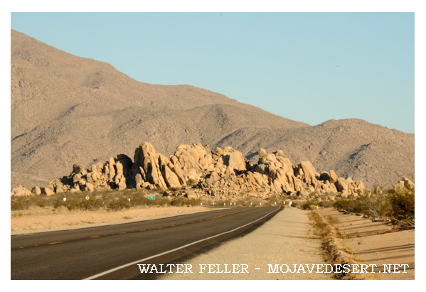
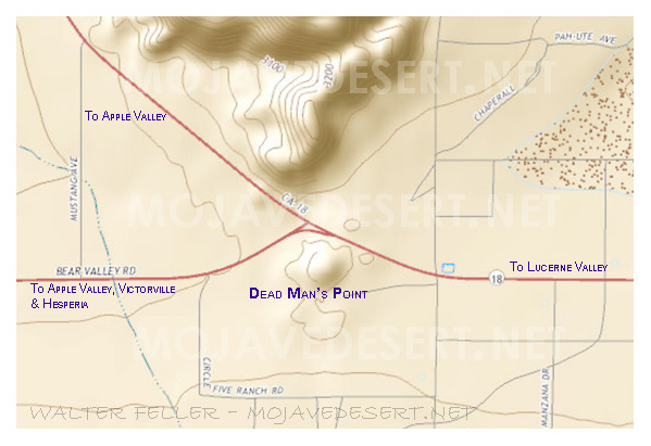
Dead Mans Point is a natural rock formation located at the junction of state highway 18 and Bear Valley road between the high desert communities of Lucerne Valley and Apple Valley about 11 miles southeast of Victorville.
How did the point get the name?
Story #1: In 1885 W.W. Brown, traveling from Victor to the Box S Ranch, found a man lying dead here. Blankets and the contents of a pack were scattered around him.
Story #2: In 1887 Edward Dolch was told that an unidentified man had been found under a large juniper tree on the south side of the point.
Story #3: In 1896 James Goulding heard that a miner from Holcomb Valley got drunk and missed his ride back to the mountains, so he started walking. Instead of carrying water, he carried a bottle of whiskey, which he had emptied by the time he reached the point. A teamster found him lying dead in the shadow of a big rock.
Story #4: From certain angles Dead Mans Point looks like a dead man lying on his back with his arms folded over his chest.
Source - Mojave Desert Dictionary by permission Pat Schoffstall:
Mojave River Valley Museum


Jack Morgan, Wall of Death