|
|
Mojave Desert Map:
Antelope Valley
The valley was named for the graceful animals that are said to have roamed there until being eliminated by hunters and bad weather in
the 1880s. The principal cities in the Antelope Valley are Palmdale and Lancaster.
The Antelope Valley, nestled between the San Gabriel and Tehachapi Mountains, marks the western edge of the Mojave Desert. It spans about 3,000 square miles, stretching across northern Los Angeles and southeastern Kern Counties. Today, cities like Palmdale, Lancaster, Mojave, and Rosamond are its hubs, but people have lived and traveled through this valley for thousands of yearstraders, hunters, and eventually settlers.
Long before it became known for aerospace, this valley was named for the antelope that once roamed freely until overhunting and harsh weather wiped them out by the 1880s. Native people had used this route for trade between the Southwest and Californias coast. Spanish explorers first arrived in the 1770s, but permanent non-native settlement took off in the 1850s, after California joined the U.S.
Key milestones came quickly: gold mining nearby, cattle ranching, and the Butterfield stage route in 1858. A telegraph line followed in 1860, then the railroad in 1876. Early farming boomed thanks to generous rainfalluntil a crushing drought in the 1890s forced many off their land. Still, irrigation and electricity revived agriculture by the early 1900s. The 1913 Owens Valley Aqueduct helped too, feeding the growth of both Los Angeles and the Antelope Valley.
Today, though farming still lingers, the valleys economy runs on aerospace and defense, with wide skies and open land perfect for high-tech flight and testing.
Historical Timeline
c. 9000 BCE Indigenous peoples, likely ancestors of the Kitanemuk and other local tribes, begin using the Antelope Valley for seasonal travel and trade. The valley serves as a crossroads between the Mojave Desert and coastal regions.
1772 Spanish explorer Pedro Fages passed through the Antelope Valley during early inland expeditions north of San Gabriel Mission.
1800s (early) The valley remains sparsely used by Spanish and later Mexican ranchers, with little permanent non-native settlement.
1848 California becomes part of the United States following the Mexican-American War. American settlers begin trickling in.
1854 Fort Tejon is established to the west of the valley. It becomes a military post and supply route, protecting settlers and goods traveling through Grapevine Canyon and the valley floor.
1858 The Butterfield Overland Mail sets up a stagecoach route crossing the valley, including stops near present-day Lancaster and Mojave.
1860 The Los Angeles to San Francisco telegraph line cuts across the valley, a key advancement in communication.
1860s1870s: Ranching became more common as open land and rail access attracted cattlemen. H.J. Butterworth and others ran large cattle operations.
1876 The Southern Pacific Railroad reaches the valley, connecting it with Los Angeles and the Central Valley. This leads to the development of rail towns such as Mojave.
1880s Early farming begins, especially around Lancaster and Rosamond, spurred by unusually wet weather. A few antelopes still roam the open grasslands but vanish by the decades end due to overhunting and dry winters.
1884 Lancaster is officially established as a station town along the Southern Pacific line.
1886 Mojave becomes a critical rail junction connecting the SP and the Borax routes to the desert.
1890s Agriculture spreads, especially dry farming of wheat and barley. Homesteaders attempt to settle remote areas. In 1894, a severe drought begins, devastating crops and driving many settlers away.
Early 1900s Irrigation and windmill-powered wells slowly return life to abandoned farms. Electricity arrives, helping boost productivity.
1913 The Los Angeles Aqueduct is completed by William Mulholland, delivering water from the Owens Valley to L.A. The project passes through the Antelope Valley and contributes to growth and infrastructure.
1921 Palmdale is formally incorporated as a town site, growing from a rural colony founded by Swiss and German families in the late 1880s.
1933 Muroc Army Airfield (later Edwards Air Force Base) is established. This brings a long-term military and technological presence to the valley.
1940s World War II transforms the Antelope Valley into an aerospace hub. Military testing and development expand rapidly.
1950s Both Palmdale and Lancaster grow quickly as workers settle in to support Edwards AFB and companies like Lockheed. Suburbs, schools, and civic centers appear.
1962 Palmdale is officially incorporated as a city.
1977 The space shuttle Enterprise makes its test flights at Edwards AFB, showcasing the valleys role in national aerospace history.
1980s2000s Growth continues, with the valley balancing residential expansion, agriculture, and ongoing defense contracting work.
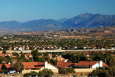
Today Palmdale and Lancaster anchor the valley, which supports farming, aerospace, solar energy, and commuters. The wide desert skies and quiet spaces remain a draw, as do the areas historical roots.
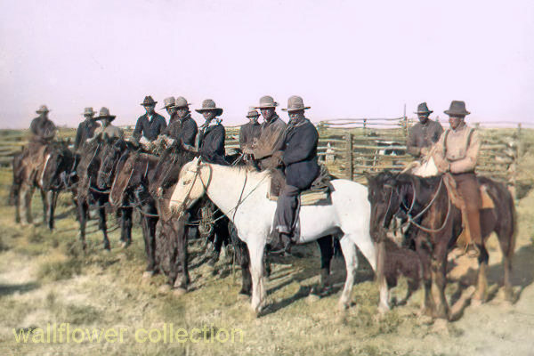
Cowboys at H.J. Butterworth Corral, c.1905-1910 - City of Lancaster Museum
|
*Antelope Valley Map
Historical Setting
Communities
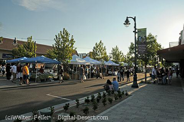
Lancaster
Palmdale
Ecology
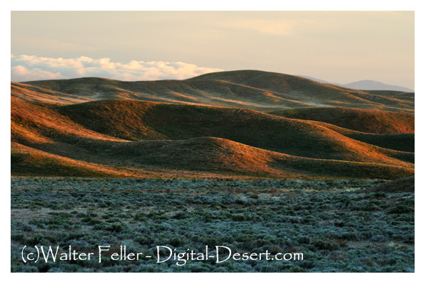
High Desert Plains & Hills
|