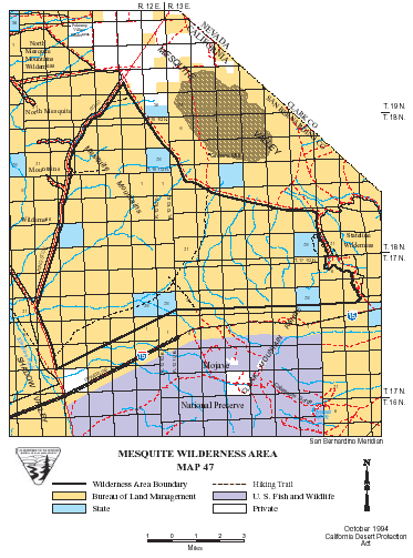
Mesquite >> Map #47
Mesquite Wilderness
SIZE: 47,330 acres
LOCATION: San Bernardino County; 50 miles northeast of Baker, California
NATURAL RESOURCES: As one of the three wilderness areas covering the Clark Mountain Range, this triangular-shaped area is named for the Mesquite Mountains, which are found in the western portion of the wilderness is rough and rocky with numerous small caves in the porous rock. Plant species include creosote brush sage on the bajadas to blackbrush and Joshua trees at the higher elevations.
| GLOSSARY | > bajada |
ACCESS: To access the southwestern corner of the wilderness, take the Cima Road exit from interstate 15 (26 miles east of Baker) and travel north for approximately 7 miles on the paved Excelsior Mime Road. The boundary is 500 feet northeast of the centerline of the road for the next 3 miles. The Kingston Road, bearing right from the Excelsior Mine Road, forms the northern boundary of the wilderness.
