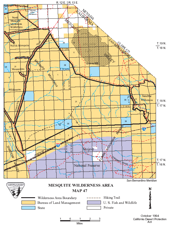
Digital-Desert : Mojave Desert
Intro:: Nature:: Map:: Parks:: Points of Interest:: Ghosts & Gold:: Communities:: Roads & Trails:: People & History:: BLOG:: Weather:: :?:: glossary

Wilderness - MAP
Mesquite >> Map #47

Mesquite Wilderness

SIZE: 47,330 acres

LOCATION: San Bernardino County; 50 miles northeast of Baker, California

ACCESS: To access the southwestern corner of the wilderness, take the Cima Road exit from interstate 15 (26 miles east of Baker) and travel north for approximately 7 miles on the paved Excelsior Mime Road. The boundary is 500 feet northeast of the centerline of the road for the next 3 miles. The Kingston Road, bearing right from the Excelsior Mine Road, forms the northern boundary of the wilderness.


Intro:: Nature:: Map:: Parks:: Points of Interest:: Ghosts & Gold:: Communities:: Roads & Trails:: People & History:: BLOG:: Weather:: :?:: glossary
Digital-Desert : Mojave Desert
Country Life Realty
Wrightwood, Ca.
Mountain Hardware
Wrightwood, Ca.
Canyon Cartography
G.A. Mercantile


Grizzly Cafe
Family Dining


Abraxas Engineering
privacy

Disclaimer: Some parts of this project were created with help from AI tools to fill in gaps or model historical patterns. Everything has been reviewed and fact-checked by real people to make sure it’s as accurate and useful as possible, though not every detail can be guaranteed. The goal is to offer solid starting points and unique niches for your own studies, exploration, and deeper research.

These items are historical in scope and are intended for educational purposes only; they are not meant as an aid for travel planning.
Copyright ©Walter Feller. 1995-2025 - All rights reserved.