Digital-Desert : Mojave Desert |
Intro:: Nature:: Map:: Parks:: Points of Interest:: Ghosts & Gold:: Communities:: Roads & Trails:: People & History:: BLOG:: Weather:: :?:: glossary |
-- |
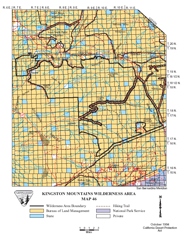
Wilderness - MAP Kingston Range >> Map #46 Kingston Range Wilderness SIZE: 209,608 acres LOCATION: San Bernardino County; 50 miles northeast of Baker, California ACCESS: Access the wilderness from State Highway 127; the Old Spanish Trail Highway; or the eastern boundary from the Excelsior Mine Road via Cima Road off Interstate 15 (26 miles east of Baker). |
Intro:: Nature:: Map:: Parks:: Points of Interest:: Ghosts & Gold:: Communities:: Roads & Trails:: People & History:: BLOG:: Weather:: :?:: glossary |
Country Life Realty Wrightwood, Ca. |
Mountain Hardware Wrightwood, Ca. |
Canyon Cartography |
DesertLink Links to Desert Museums |
Grizzly Cafe Family Dining |
Abraxas Engineering privacy |
These items are historical in scope and are intended for educational purposes only; they are not meant as an aid for travel planning. Copyright ©Walter Feller. 1995-2024 - All rights reserved. |