|
Digital-Desert :
Mojave Desert
|
| Intro:: Nature:: Map:: Parks:: Points of Interest:: Ghosts & Gold:: Communities:: Roads & Trails:: People & History:: BLOG:: Weather:: :?:: glossary |
|
|
Wilderness - MAP 
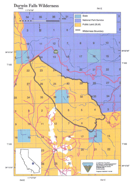
Darwin Falls >> Map #65 Darwin Falls Wilderness SIZE: 8,600 acres LOCATION: Inyo County; 3 miles north of Darwin, California and 25 miles northeast of Olancha, California ACCESS: Access to this wilderness is via State Highway 190 through Panamint Valley approximately 30 miles east of Olancha and along the road into Darwin or down the Darwin Canyon Road. Travelers should check road conditions before driving.
|
| Intro:: Nature:: Map:: Parks:: Points of Interest:: Ghosts & Gold:: Communities:: Roads & Trails:: People & History:: BLOG:: Weather:: :?:: glossary |
|
Digital-Desert :
Mojave Desert
|
|
Country Life Realty Wrightwood, Ca. |
Mountain Hardware Wrightwood, Ca. |
Canyon Cartography |
G.A. Mercantile |
Grizzly Cafe Family Dining |
|
Abraxas Engineering privacy |
Disclaimer: Some portions of this project were developed with assistance from AI tools to help reconstruct historical contexts and fill informational gaps. All materials have been reviewed and fact-checked to ensure accuracy and reliability, though complete precision cannot be guaranteed. The aim is to provide dependable starting points and distinctive perspectives for further study, exploration, and research. These materials are historical in nature and intended for educational use only; they are not designed as travel guides or planning resources. Copyright - Walter Feller. 1995-2025. All rights reserved. |