Route 16
Shoshone/Tecopa & the Old Spanish Trail
This fascinating route takes you far into quiet, hidden places steeped in a rich history. It can be driven in an hour but allow a full day to explore the charms of Shoshone, hot springs, date palms, rivers and wetland, wild cactus-studded mountains, and the old wagon trail.What to expect: Paved except for 7.8 miles of graded dirt.
Length: 36 mile loop.
Driving time: 1 hour.
Getting there: Shoshone, just south of the intersection of Highways 127 and 178 east of Death Valley National Park, is the beginning of the route.
Along the route: Shoshone is an attractive little shady oasis whose entire main street can be seen at a glance but is full of historical curiosities to explore. The tourist information center on the east side of the road near the south end of town can direct you on a selfguided walking tour. Dont miss the museum, recently expanded to accommodate a whole mammoth skeleton excavated nearby. Ask about the caves just west of town which were dug out of the soft rock and inhabited in recent historic times. Set your trip meter at Shoshone and head south along Highway 127.
At 5.2 miles take a left turn toward Tecopa Hot Springsa paved road that angles southeast. Youll soon pass through Grimshaw Lake Natural Area with fine opportunities to observe birds of the wetlands. Tecopa Hot Springs county park offers free bathing in the hot mineral springs, and camping for a fee.
At 9.6 miles go left at the Y intersection with the Old Spanish Trail.
At 11.1 miles make a right turn onto Furnace Creek Road, a rough paved road. At 12.8 miles youll find the turnoff to the China Ranch date farm. Take this road as it plunges downward for two miles into Amargosa Canyon. At the ranch is trailhead parking for the Amargosa River, which runs largely underground but surfaces here to form a lush riparian area on public land. The privately-owned ranch offers a selfguided walking tour of its groves with several varieties of date palm.
Reset your trip meter to zero when you return to the main road, turn right and continue southeast. At 2.4 miles turn right onto a dirt road that goes straight south along a line of power poles and, in less than half a mile, ends abruptly at a scenic view of the Amargosa River in the canyon bottom far below.
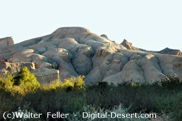
Once again reset your trip meter at the main road and turn right. The road soon loops northward; here, in the foothills to the left, you can see a group of silver and lead mines which operated intermittently from the 1860s to the 1960s. They are on private property and closed to the public. The road turns southeastward again and at 4.5 miles it forks: where the pavement veers right, go straight onto the graded dirt Mesquite Valley road. Reset your trip meter. This road trends northeast as it traverses the edge of the South Nopah Range Wilderness. You can park anywhere, walk up westward into the range and enjoy the cactuses and Joshua trees. To the east is a vast, quiet valley abandoned by homesteaders. Two deserted cabins built by a Swiss family in the 1940s are reached via a half mile on a graded dirt road that turns off the Mesquite Valley road after its first mile and a half. Three and a half miles along the Mesquite Valley road is a lonely cottonwood tree and ruined foundation marked on maps as Davis Well.
At 7.8 miles you return to the paved Old Spanish Trail road. Go left and reset your trip meter one more time. Youll approach a hill and pass a 15 MPH turn sign. Continue on pavement to the crest of the hill and at 2.4 miles, just as the road begins to drop down and just before a zigzag turn sign, turn right onto an unmarked dirt road. Follow it to the top of a small hill, park, get out and look east.
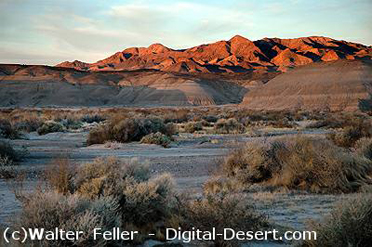
From here the Old Spanish Trail is clearly visible as wagon marks passing to the south of a low, dark, isolated hill out on the plain below. This is the route used by Spanish, then Mexican, then American traders to travel between Santa Fe and Los Angeles while avoiding hostile tribes. It was most active from the 1830s to the 1850s. Privately-owned Resting Springs Ranch, 5 miles further along the paved road, was in those days a stopover providing water, grass for oxen and trees for repairing wagon wheel spokes.
Within 4 miles the loop is complete as you rejoin the Furnace Creek road and turn right toward Tecopa.
.. Source - BLM
Tecopa
China Ranch