-.-
Littlerock, Ca.
Littlerock lies along Little Rock Wash at the south edge of the Antelope Valley, where the Mojave Desert meets the foothills of the San Gabriel Mountains. Before American settlement, this part of the valley was within a Native landscape associated with Serrano, Kitanemuk, Tataviam, and related Shoshonean-speaking peoples. LA County Library notes that the first fully documented European contact in the Antelope Valley came in 1776, when Father Francisco Garces passed through the Mojave Desert on his way toward Monterey.
The later town began as an agricultural colony. According to LA County Library, the first non-Native settler arrived in the mid-1860s and remained until he was killed by a grizzly bear in 1886. In the early 1890s, settlers planted almonds and pears, opened a blacksmith shop, and called the place first Alpine Springs Colony and then Tierra Bonita. In 1893, the name was changed to Littlerock, and the first post office opened that same year.
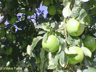
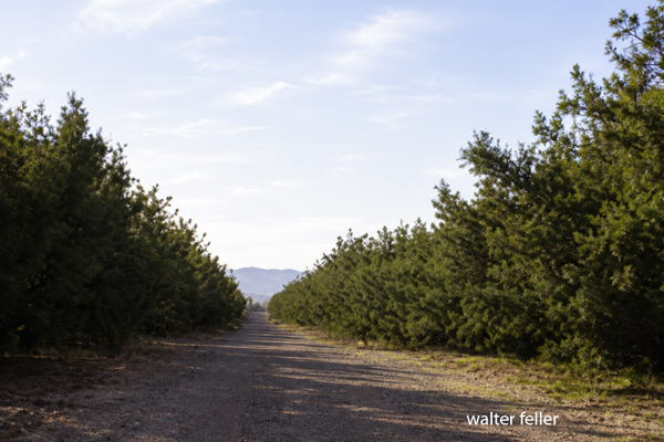
The name came from Little Rock Wash, the drainage that descends from the San Gabriel Mountains and helped make orchard farming possible in an otherwise dry valley. By the early twentieth century, Littlerock had become one of the Antelope Valley's best-known fruit districts, especially for pears, almonds, peaches, and apples. Its roadside fruit stands and orchards gave it the nickname "The Fruit Basket of the Antelope Valley."
Community institutions followed the farms. The first schoolhouse opened in 1913. In 1914, residents petitioned Los Angeles County for library service; the first library collection had 222 books and was housed in a private residence. In 1926, the library moved into Grandma's Fruit Stand, a fitting location for an orchard town.
Water shaped Littlerock's growth. Littlerock Dam, officially the Little Rock-Palmdale Dam, was completed in 1924 on Little Rock Creek. It supplied irrigation water for orchards and later became important for municipal water and flood control. Palmdale Water District notes that the dam was once regarded as the highest reinforced-concrete, multiple-arch dam in the world, though its design was controversial and required state-ordered renovations in 1932.
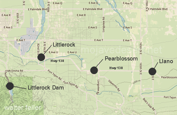
Through the twentieth century, Littlerock remained more rural than Lancaster or Palmdale. Highway 138 became the main commercial corridor, lined with orchards, fruit stands, antique stores, small businesses, and scattered homes. The surrounding area also blended with neighboring Sun Village and Pearblossom, so population figures can vary depending on whether one means the official census-designated place or the broader community. The official Littlerock CDP had 1,535 residents in the 2020 census, while the wider Littlerock-Sun Village area is often described as having a much larger population.
Today Littlerock remains an unincorporated Los Angeles County community. Its identity is still tied to orchards, the old highway, foothill water, and the agricultural settlement pattern of the eastern Antelope Valley. Its history is the story of a small desert-edge colony that survived by turning mountain runoff into fruit land.
Littlerock Dam
Serrano Indians
State Route 138
Valley of the Sun
Pearblossom
Palmdale
Eco-notesSubsection 322Ag High Desert Plains and Hills