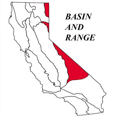
Basin and Range Geomorphic Province
The Basin and Range is the westernmost part of the Great Basin. The province is characterized by interior drainage with lakes and playas, and the typical horst and graben structure (subparallel, fault-bounded ranges separated by downdropped basins). Death Valley, the lowest area in the United States (280 feet below sea level at Badwater), is one of these grabens. Another graben, Owens Valley, lies between the bold eastern fault scarp of the Sierra Nevada and Inyo Mountains. The northern Basin and Range Province includes the Honey Lake Basin.
List of Faults & Fault Zones
Sierra Nevada Fault Zone- Independence Fault
Owens Valley Fault Zone
Hunter Mountain Fault Zone
- Saline Valley Faults
Airport Lake Fault Zone
Little Lake Fault Zone
Wilson Canyon Fault
Panamint Valley Fault
- Ash Hill Fault
Tank Canyon Fault
Brown Mountain Fault
Furnace Creek Fault Zone
Death Valley Fault Zone
Owl Lake Fault
Garlock Fault Zone
Ecosections:
Southern Great Basin
Widely separated short ranges in desert plains. Contains isolated mountains, plateaus, alluvial fans, playas, basins and ...Mojave Desert
Widely separated short ranges in desert plains. Contains isolated mountains, plateaus, alluvial fans, playas, basins and ...Owens Valley
This subsection contains mostly Quaternary alluvial fan, basin-fill, and lacustrine deposits. There is some ...Panamint Valley
This subsection is on predominantly nearly level lake plain and basin floor and gently to moderately sloping ...National & State Parks
Death Valley
Hottest, Driest, Lowest: Death Valley is a land of extremes. It is one of the hottest places on the ...Red Rock Canyon
Red Rock Canyon State Park features scenic desert cliffs, buttes and spectacular rock ...Trona Pinnacles
This eerie, fantastic landscape is one of the most unique geological features in the ...source - California Geologic Survey

Death Valley Regional Geology
A Virtual Field Trip & GuideDeath Valley is perhaps the most geologically diverse region in the world. In terms of petrology, landforms, geologic structures, stratigraphy and tectonic history, the region has ...