--
Sanford Pass
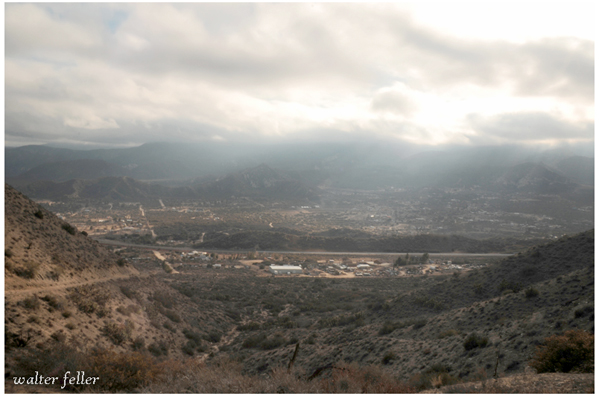
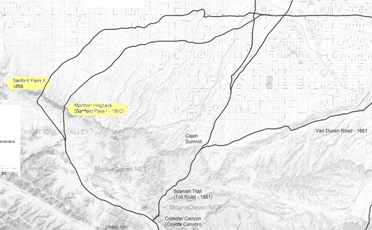
For centuries the Cajon Pass this been an important thoroughfare for travelers and traders between the Mojave Desert and Southern California. Following the route of the Old Spanish Trail, most travelers transited the pass on its east side. This route, however, was very narrow and rocky, and was less than suitable for wagon travel. In 1850, William T. B. Sanford constructed a much better wagon road through the West Cajon pass. This route, departed from the Old Spanish Trail near present-day Victorville, crossed Baldy Mesa Ridge and turned down through West Cajon Canyon to Mormon Rocks, then rejoined the Old Spanish Trail near the present location of the Interstate 15 truck scales.
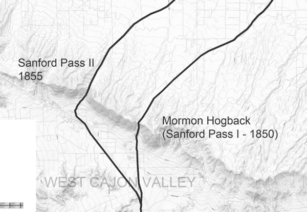
Known variously as the Sanford crossing, Sanford cutoff, or Sanford Pass, this westerly transit was less rocky than its eastern counterpart, but was still very steep at its summit. On the descent, cattle and wagons often slid the first 50 feet; on the ascent, it was necessary to hitch as many as 32 mules to each wagon. In 1855, Sanford and Phineas banning constructed a new alignment about 1 1/2 miles west of his original road. Although it was an improvement over his earlier route, grades were still steep as 30%. The arduous ascent and its descent of the Sanford Cutoff troubled freighters until the completion of the John Brown tollroad through Coyote Canyon (now called Crowder Canyon) on the east side of Cajon Pass in 1861.
Adapted from: Billy Holcomb Chapter of the Ancient and Honorable Order of E Clampus Vitus.
Historic Wagon Roads
Cajon Pass Toll Road
Historic Wagon Roads
John Brown
Toll Road in the Pass
Mormon Hogback
Sanford Pass
Van Dusen Road
Cajon Pass Toll Road
Sanford Pass - West Cajon
(El Cajon de los Negros) - WilliamsonMore rugged and steep, developed into a wagon route by William T. Sanford, freighting for Phineas Banning in 1850. Banning was bringing supplies to the Salt Creek gold mine on the Amargosa River. This route became an important wagon route for immigrants whose destination was Los Angeles or points north, as it was shorter than the older trail. The route followed Lower Swarthout Canyon to West Cajon Valley and over the summit.
--
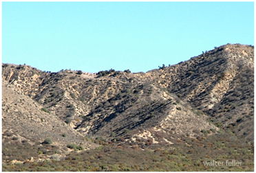
Mormon Hogback
Sanford's Road