Sylvania Mountains >> Map #69
Sylvania Mountains Wilderness
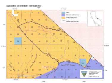
SIZE: 17,820 acres
LOCATION: Inyo County; 30 miles east of Bishop, California
NATURAL RESOURCES: Sitting near the California-Nevada border, the terrain within the Sylvania Mountains Wilderness starts on the desert floor. Gradually rolling hills the western boundary give way to rough and mountainous rock rising to nearly 8,000 feet on the eastern boundary. Sagebrush scrub grows at the lower elevations and pinyon-juniper pine thrive along the mountain peaks. The Last Chance Range, Piper Mountain and Fish Lake Valley can all be viewed from this wilderness, providing a sense of vastness. Desert bighorn sheep roam this area, which is also home to deer and chuckar.
| GLOSSARY | > |
ACCESS: Access to this wilderness from the north is via State Highway 168, approximately 32 miles north and east of Big Pine and along F-0756; and from the south via Big Pine-Death Valley Road, approximately 34 miles east of Big Pine and along North Eureka Road (F- 1373). Check road conditions before driving.