|
Digital-Desert :
Mojave Desert
|
| Intro:: Nature:: Map:: Parks:: Points of Interest:: Ghosts & Gold:: Communities:: Roads & Trails:: People & History:: BLOG:: Weather:: :?:: glossary |
|
|
Wilderness - MAP 
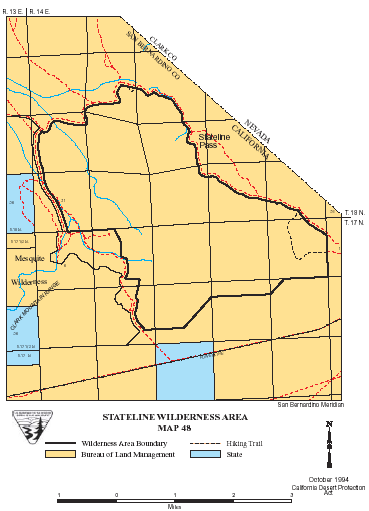
Stateline >> Map #48 Stateline Wilderness SIZE: 7,050 acres LOCATION: San Bernardino County; 3 miles northwest of Stateline, Nevada NATURAL RESOURCES: The Stateline Wilderness lies on the edge of the California-Nevada border, thus its name. A rocky, mountainous and isolated portion of the Clark Mountains make up the majority of the wilderness. Bighorn sheep cross this wilderness as they migrate between the Clark Mountains and the Spring Mountains located in Nevada.
ACCESS: To access this wilderness, exit Interstate 15 at Stateline. Go north from the Primadonna Resort on the Stateline Pass Road. The wilderness is due west of this road. The eastern boundary of the wilderness generally follows the road north, then diverges at the historic traction, finally returning to Stateline Pass Road at the pass. High clearance vehicles are recommended. |
|
| Intro:: Nature:: Map:: Parks:: Points of Interest:: Ghosts & Gold:: Communities:: Roads & Trails:: People & History:: BLOG:: Weather:: :?:: glossary |
|
Digital-Desert :
Mojave Desert
|
|
Country Life Realty Wrightwood, Ca. |
Mountain Hardware Wrightwood, Ca. |
Canyon Cartography |
G.A. Mercantile |
Grizzly Cafe Family Dining |
|
Abraxas Engineering privacy |
Disclaimer: Some portions of this project were developed with assistance from AI tools to help reconstruct historical contexts and fill informational gaps. All materials have been reviewed and fact-checked to ensure accuracy and reliability, though complete precision cannot be guaranteed. The aim is to provide dependable starting points and distinctive perspectives for further study, exploration, and research. These materials are historical in nature and intended for educational use only; they are not designed as travel guides or planning resources. Copyright - Walter Feller. 1995-2025. All rights reserved. |