p
Digital-Desert : Mojave Desert |
Intro:: Nature:: Map:: Parks:: Points of Interest:: Ghosts & Gold:: Communities:: Roads & Trails:: People & History:: BLOG:: Weather:: :?:: glossary |
-- |
Mojave National Preserve -
Mojave Road
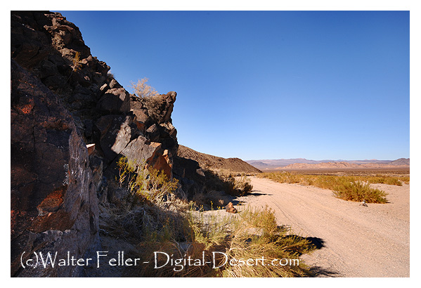
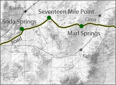
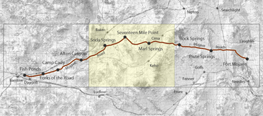
Seventeen Mile Point17 Mile Point is the approximate halfway point on the Mojave Road between Soda Springs and Marl Springs. Just west of the point is a dry camp where pioneers and freighters would stop for the night. The route was especially challenging for travelers heading east toward the Colorado River. The road was sandy, hard on mules, livestock, and people alike. There was little, if any, grass for livestock to feed on the climb to Marl Springs. Seventeenmile PointIn 1859 the U.S. Army established Fort Mojave on the east bank of the Colorado north of Needles to guard the important river crossing at the Mojave Villages. The Mojave (or Old Government) Road came into being to link the fort with the Port of Los Angeles. Supplies, troops, and mail traveled over this route, with many heavy wagons traveling eastward. The portion from Soda Springs (now Zzyzx) to Marl Springs was approximately 35 miles, the longest waterless stretch on the trail. It also gained 3,000 feet in elevation over this distance, much of the way over deep, soft sand. This northern-most spur of Old Dad Mountain, midway between the two waterholes, was known as Seventeenmile Point. In an attempt to avoid the worst of the desert heat, heavily laden supply wagons would typically leave Soda Springs at night, make a dry camp nearby, and continue on the next day to the dependable water at Marl Springs.https://www.hmdb.org/m.asp?m=159025 |
Silurian Valley - Devil’s PlaygroundThis subsection includes the alluvial plain of the Silurian Valley, from where the Amargosa River enters it on the north to where the Mojave River ...Chemehuevi IndiansThe Chemehuevi territory lay off the lower Colorado River north and west toward Death Valley and west to about ...Mojave PreserveMojave National Preserve is a 1.6 million-acre unit of the National Park Service, established by Congress on October 31, 1994, by the California Desert Protection Act. ...The Pinch of the JourneyOur next jornada constitutes the pinch of the journey, and an early start is essential. We breakfast by the light of the camp fires and the morning star. At the first streak of dawn our waggon-master sings out, ... |
Intro:: Nature:: Map:: Parks:: Points of Interest:: Ghosts & Gold:: Communities:: Roads & Trails:: People & History:: BLOG:: Weather:: :?:: glossary |
Country Life Realty Wrightwood, Ca. |
Mountain Hardware Wrightwood, Ca. |
Canyon Cartography |
DesertLink Links to Desert Museums |
Grizzly Cafe Family Dining |
Abraxas Engineering privacy |
These items are historical in scope and are intended for educational purposes only; they are not meant as an aid for travel planning. Copyright ©Walter Feller. 1995-2024 - All rights reserved. |