Indian Trails & Trade Networks
Mojave Indian Trail via the Devil-Cable Canyon ridge to Sawpit Canyon to the Mohave River (Walker's Trail, after Ute Chief Walker or Wakara, cf . Beattie, p. 3)This trail closely follows the river bed, along which there were Indian rancherias at occasional intervals. The earliest travellers who penetrated this part of the Mohave Desert followed this old Indian route. Jedediah Smith on his second trip through the area in 1827, broke away from the river and headed directly west toward the mountains in the distance. This is the first recorded instance of the use of the shorter route (Morgan and Wheat, 1954) which would later become the most popular trail.
The first European documented to have crossed from the San Bernardino area to the Mohave Desert via Cajon Pass is Pedro Fages in 1772. Unfortunately his note of the trip is too vague to tell precisely which route he may have used. He did not name the pass.
In 1776, Father Francisco Garces crossed from east to west across Cajon Pass via the old Mohave Indian route. He did not name the pass.
Padre Zalvidea may have crossed also from east to west in 1806, not naming the pass but noting that there was a "present Camp Cajon" in the canyon. Jedediah Smith in 1826 and 1827 also used the pass, not naming it either time. In 1826 he arrived from the desert via the Mojave trail, and in 1827 via the shorter Cajon Pass route (Morgan and Wheat, 1954).
Armijo in 1830 arrived from Santa Fe with the first New Mexican commercial caravan. It is not clear which pass he used. He followed the Mojave River for seven days before rendezvousing with his detachment sent ahead to San Bernardino for supplies. He named one stop at San Bernardino Canyon, and then the stopping place of San Jose. These localities cannot be precisely identified.
The Cajon Pass roads joined the Mohave Indian trail near the present town of Oro Grande. The earliest trail, followed by the Mohave Indians, was used as a trade route from prehistoric times. It followed the Mohave River to its sink where it struck out across the desert to the distant Colorado River near the Needles. The Indian place namesgiven the stops along the route have not survived,
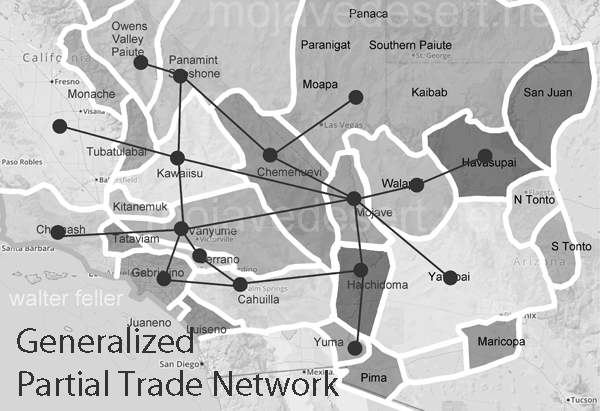
This map shows a portion of Indigenous trade networking in and around the California Mojave. Note the Mojave River corridor in the same basic alignment as the Interstate 40 freeway and south alone the Mojave River to the Cajon Pass. Plenty of trails going back and forth across the Sierra linking to the desert network and the southern California network connecting to the south. (This is not a comprehensive inventory of trails, but rather more of an example of both the simplicity and complexity working together to form successful trade relations between unrelated tribes.)
Elizabeth Warren, Ralph Joseph Roske - 1981 - California
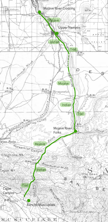 Mojave Indian Trail through Victor Valley to San Bernardino