Owens Peak >> Map #51
Owens Peak Wilderness
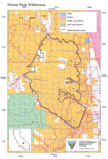
SIZE: 74,640 acres
LOCATION: Kern, Tulare and Inyo Counties; 15 miles northwest of Ridgecrest, California
NATURAL RESOURCES: The majority of this wilderness is comprised of the rugged eastern face of the Sierra Nevada Mountains. Owens Peak, the high point of the southern Sierra Nevada's, rises more than 8,400 feet. The mountainous terrain has deep, winding, open and expansive canyons, many which contain springs with extensive riparian vegetation. This area is a transition zone between the Great Basin, Mojave Desert and Sierra Nevada ecoregions. Vegetation varies considerably with a creosote desert scrub community on the bajadas, scattered yuccas, cacti, annuals, cottonwood and oak trees in the canyons and valleys and a juniper-pinyon woodland with sagebrush and digger/grey pine on the upper elevations. Wildlife includes mule deer, golden eagle and prairie falcon. Evidence of occupation by prehistoric peoples has been found throughout the wilderness. The Pacific Crest Trail passes through the wilderness along the crest and western side.
| GLOSSARY | > bajada, canyon, ecosystem, spring |
ACCESS: Access this wilderness from the south via Canebrake Road, off State Highway 178; from the east via U.S. Highway 395 north of Inyokern and along four-wheel drive- recommended routes into Indian Wells Canyon, Short Canyon, Sand Canyon, and No Name Canyon; and from the north via U.S. Highway 395 north Inyokern along Ninemile Canyon Road.