Inyo Mountains >> Map #67
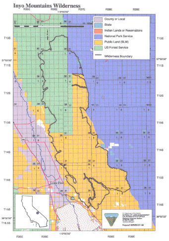
Inyo Mountains Wilderness
SIZE: 205,020 acres
LOCATION: Inyo County; 5 miles east of Lone Pine, California
NATURAL RESOURCES: Managed by the Bureau of Land Management and Inyo National Forest, this wilderness encompasses a large portion of the Inyo Mountains, which rise to 11,000 feet at Keynote Peak and separates the Owens Valley on the west and Saline Valley on the east. These mountains have maintained most of their pristine character due to the sheer ruggedness of the terrain. Evidence of historic and prehistoric man's use of the area has been found. Vegetation includes creosote, shadscale scrub, big sagebrush, lush riparian areas in most of the canyons on the eastern slope and pinyon-juniper woodland, bristlecone and limber pine on the higher reaches. Wildlife include desert bighorn sheep and the Inyo Mountain salamander.
| GLOSSARY | > |
ACCESS: Access the southern boundary via the San Lucas Canyon or Cerro Gordo roads. The west and northern reaches via the Lone Pine-Owenyo and Mazourka Canyon Roads, and the east via Saline Valley Road. A four-wheel drive vehicle and advanced driving and survival skills are suggested.