Digital-Desert : Mojave Desert |
Intro:: Nature:: Map:: Parks:: Points of Interest:: Ghosts & Gold:: Communities:: Roads & Trails:: People & History:: BLOG:: Weather:: :?:: glossary |
-- |
Wilderness - MAP 
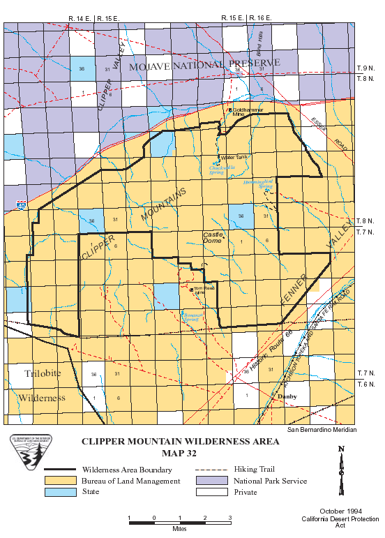
Clipper Mountain >> Map #32 Clipper Mountain Wilderness SIZE: 26,000 acres LOCATION: San Bernardino County; 50 miles west of Needles, California ACCESS: This wilderness is approximately 28 miles east of Ludlow, California and South of Interstate 40. Access the southern boundary from Route 66, east from the Ludlow to Danby Road. Go north 2.3 miles on this dirt road to the intersection of the Southern California Gas Pipeline, which forms the southern boundary of the wilderness. A high clearance vehicle is recommended. Parking is not permitted along the pipeline road right of way, therefore, you must be dropped off and picked up. ![]() |
Intro:: Nature:: Map:: Parks:: Points of Interest:: Ghosts & Gold:: Communities:: Roads & Trails:: People & History:: BLOG:: Weather:: :?:: glossary |
Country Life Realty Wrightwood, Ca. |
Mountain Hardware Wrightwood, Ca. |
Canyon Cartography |
DesertLink Links to Desert Museums |
Grizzly Cafe Family Dining |
Abraxas Engineering privacy |
These items are historical in scope and are intended for educational purposes only; they are not meant as an aid for travel planning. Copyright ©Walter Feller. 1995-2024 - All rights reserved. |