Hesperia, California
Hesperia's Past
The City's history stretches far beyond its 1988 incorporation. Hesperia's past is rich with the history of the Spanish settlers of the 1781 land grant Rancho San Felipe, Las Flores y el Paso Del Cajon, and later the westward travelers of the Mormon Trail. Before these times however, the area was sparsely populated by the Serrano Indians who called the area Topipa.
Max Stroebel, who was to become known as the Father of Orange County, acting as agent for a syndicate bought 50,000 acres of land encompassing much of what makes Hesperia today. The land was in anticipation of a railroad which was not to be for nearly 15 years, far too long for the investors. The land was sold at a loss and became the property of a German Temperance Colony.
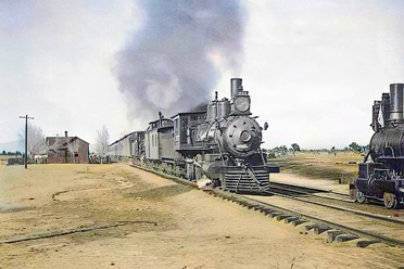
The first major turning point in present day Hesperia occurred in 1885, when the California Southern railroad tracks were completed. This resulted in Hesperia's first industry, providing juniper wood to bakers in Los Angeles by way of train. Juniper is a very hard wood that was used as fuel for kilns up until the early 1900s, when oil became the principal fuel for bakers. That change in technology did not slow Hesperia's progress.
The 1900s were a booming time with the increased popularity of automobiles. The City served as the last stopping point before travelers made the treacherous trip down the Cajon Pass.
Historical Essay
Hesperias history is not a story of sudden founding or dramatic boom, but of slow settlement, repeated testing, and eventual permanencea pattern typical of High Desert basin communities.Speculation and Irrigation Ideals
In the late 19th century, large tracts were acquired by investors hoping to replicate irrigation successes elsewhere in Southern California. The Chaffey brothersbest known for Ontario and Etiwandadid not build Hesperia, but their irrigation-based colonization model influenced how promoters imagined its future.Those ambitions were never realized here. The basin lacked storage, capital, and reliable surface water. Irrigation schemes faltered, and many early settlers left. Hesperia did not collapse; it simply endured quietly.
Railroad Era and Service Settlement
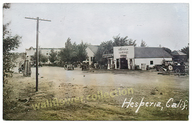
The arrival of the California Southern Railroad in 1885 brought limited change. Hesperia never became a rail town, but it gained modest importance as a service point. One early industry involved harvesting juniper wood for shipment to Los Angeles bakeries. As automobile travel increased, Hesperia found a steadier role: the last dependable stop before descending Cajon Pass. Livery stables, a hotel, a schoolhouse, and small businesses served travelers rather than exploiting local resources.Local Enterprise and Promotion
During the early 20th century, figures such as Penn Phillips represent Hesperias ground-level realitylocal enterprise, promotion, and persistence rather than grand development. Phillips efforts reflected a common High Desert pattern: promote what exists, work within limits, and hope attention brings opportunity.In the 1920s and early 1930s, Phillips promotions were briefly amplified through association with Jack Dempsey, whose national fame brought notice but not transformation. This was promotion, not settlementa short-lived spotlight that left little permanent mark.
Water, Wells, and Endurance
Repeated irrigation and water-delivery schemes failed or proved unstable. At times, centralized water systems ceased operating entirely. Hesperia survived nonetheless by relying on private wells and groundwater, drawing from Mojave River underflow.This persistence is key. Hesperia was never dependent on a single corporate water system. It endured because it adapted locally.
Postwar Growth and Local Control
After World War II, highways and Southern Californias outward growth brought steady population increase. Informal water arrangements became inadequate, leading to the formation of the Hesperia Water District, a locally governed groundwater utility.This marked the towns shift from endurance to institutional stability.
Incorporation and Character
Hesperia incorporated as a city in 1988, formalizing governance while retaining its basin-oriented character: spread-out development, groundwater dependence, and adjustment to limits rather than reliance on boom economies.Hesperias past is defined not by spectacle, but by staying put. Promotion came and went; water schemes failed; traffic shifted. What remained was a town built slowly, by people who adapted to the desert instead of trying to remake it.
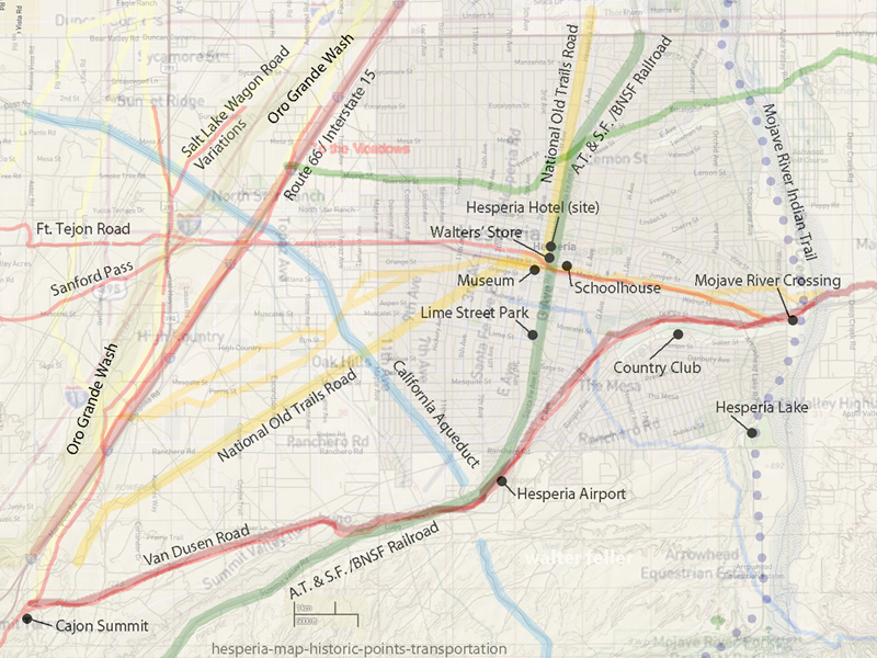
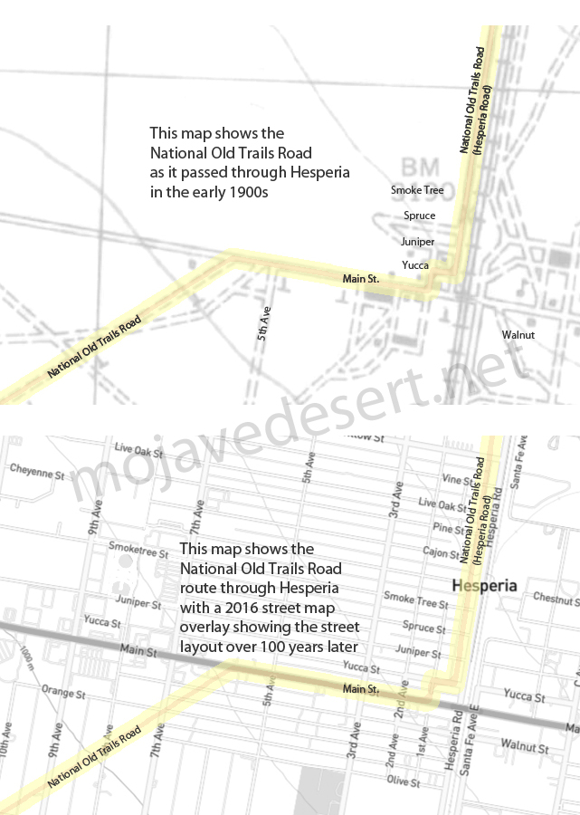
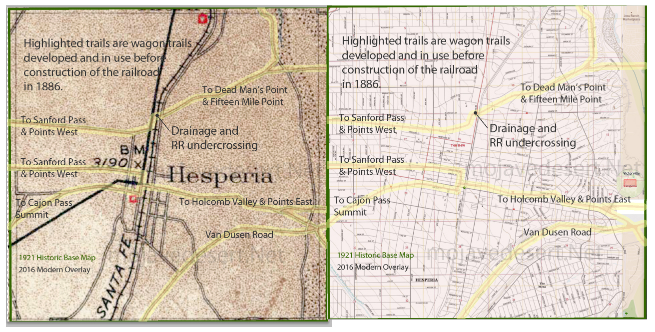
Hesperia wagon roads prior to National Old Trails Road
About Hesperia
Population - 90,100
Square Miles - 26
Elevation - 3191
About 32 miles north of San Bernardino, California
1840s1860s Emigrant and Mormon Trail traffic toward Cajon Pass.
1869 Max Stroebel acquires ~35,000 acres (courthouse record).
18711885 German colonization groups / 35th Parallel Association.
AprMay 1885 Rapid transfers (Finck ? McNeil).
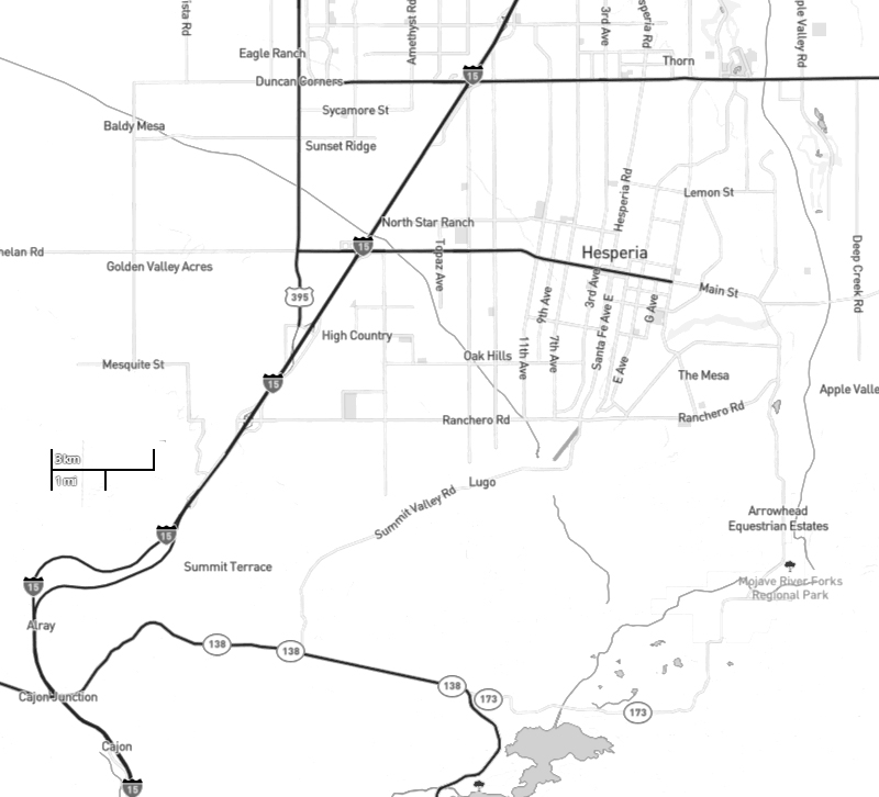
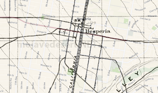
1885 California Southern Railroad completed; Hesperia becomes a minor service point.
May 6, 1886 Hesperia Land and Water Company takes over; Widney and Chaffey brothers involved.
Late 1880s Denver of the West promotion; Deep Creek water imported; townsite laid out.
1890s Flood damage to pipeline; orchards fail; decline.
1918 Jaeger encounters old Hesperia ads (Palomar Mountains).
1910s1920s Traffic shifts from the National Old Trails Road to U.S. Route 66; Hesperia serves Cajon Pass travelers.
1920 Jaeger visits Hesperia; reduced settlement observed.
Early 1920s National Old Trails Road traffic briefly revives hotel; later bypassed.
1925 Hotel vacant; lease offered unsuccessfully.
1920s1940s Quiet continuity; ranching and roadside services persist.
April 1954 Penn PhillipsJack Dempsey promotion cycle launched; grand redevelopment plans announced.
Aug 1954 Jaeger publishes retrospective in Desert Magazine.
Mid-20th century Hesperia Water District formed; groundwater governance.
1988 Incorporation as a city; basin-oriented pattern retained.
The land in the Lower Narrows of Mojave River
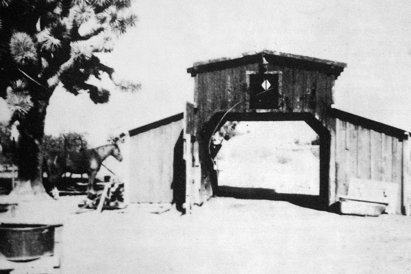
Hesperia Livery Stable c.1915
Hesperia Weather
Schoolhouse
Walters' Market
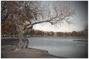
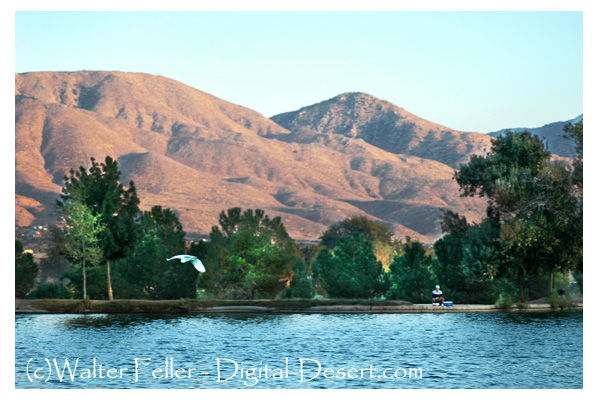
Hesperia Lake
Golf Club
Hesperia Airport
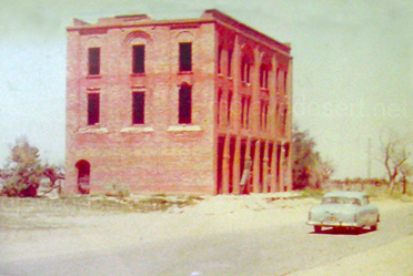
Hesperia Hotel
Flintstone House
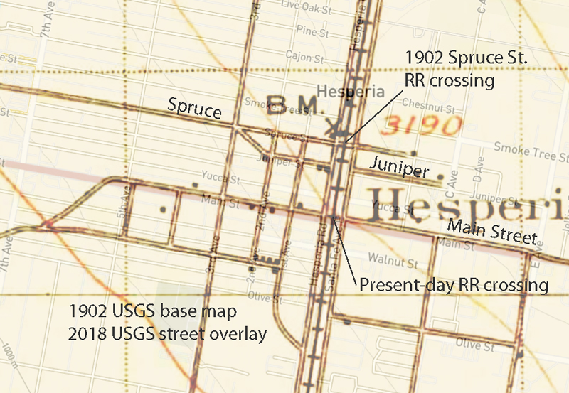
Spruce St. at grade RR crossing, 1902
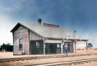
A 15 foot by 20 foot, wooden, moveable station once stood on the east side of Hesperia Road next to the railroad tracks at Spruce St. A 12 foot by 12 foot jail was built alongside. The California Southern Railroad used Hesperia for a stopping point.
Elias Hefner photo - 1900 (adapted from HMdb.org)
Lake Adelaide
.jpg)
Hesperia Ditch
A History of Hesperia
The Ghost that Refuses to Die - by E.C. JaegerHigh Desert Plains & Hills
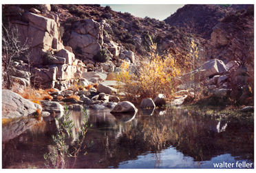
Mojave River
Vanyume Indians
They ranged along the Mojave River from Victorville/Hesperia to east of Barstow. The Vanyume (Wanyuma) are mentioned in the journal of Jedediah Smith as ...