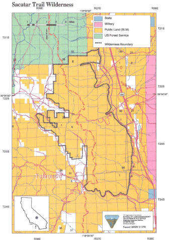
Sacatar Trail >> Map #54
Sacatar Trail Wilderness
SIZE: 51,900 acres
LOCATION: Inyo and Tulare Counties; 20 miles northwest of Ridgecrest, California
NATURAL RESOURCES: This wilderness encompasses the rugged pristine eastern face of the Sierra Nevada Mountains. Topography ranges from valley, canyons and alluvial fans to steep hills that lead into granite peaks and ridgetops reaching elevations of more that 7,800 feet. Vegetation is extremely diversified with creosote bush, desert shrubs and Joshua trees on the lower slopes and cacti and scattered pinyon-juniper woodlands on the upper slopes. Several of the canyons are complemented by springs with their riparian habitats of cottonwoods, willows and grasses. The Sacatar Trail, an old wagon road and one of the few evidences of man in this area, provides backcountry access into this wilderness. Wildlife within the area includes mule deer, golden eagle, prairie falcon, quail and dove.
| GLOSSARY | > alluvial fan, canyon, spring |
ACCESS: Access this wilderness from the east via U.S. Highway 395 north of Inyokern and along dirt routes into Sacatar Canyon, Portuguese Canyon (four-wheel drive only), Lewis Canyon (SE93), and Tunawee Canyon; and the south via U.S. Highway 395 north of Inyokern along Ninemile Canyon Road.
