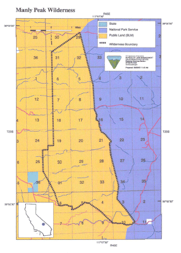
SIZE: 16,105 acres
LOCATION: Inyo County; 30 miles northeast of Ridgecrest, California
NATURAL RESOURCES: This area is entirely comprised of steep, jagged ridges and the deep canyons of the Panamint Mountains. Elevations rise sharply from 1, 100 feet along the west slopes to 6,000 feet on the east, which adjoin the new Death Valley National Park boundary. Vegetation changes with altitude, from creosote bush scrub at the lower elevations to pinyon and juniper woodlands on the higher peaks. Streams flowing from springs, within the larger canyons create riparian areas of cottonwood and desert willow and provide valuable water sources for wildlife, most notably a herd of desert bighorn sheep. This wilderness is dotted by historic mining activity.
| GLOSSARY | > canyon, spring |
ACCESS: Access this wilderness via State Highway 178 north of Trona and along, Ballarat Road. Go south on Wingate Wash Road, then east on Goler Wash Road or South Park Canyon Road (four-wheel drive vehicles only). Check road conditions before driving.Ā