-.-
East Cronese Lake
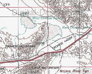
East Cronese Lake is a playa basin within the Cronese Basin complex of the ancestral Mojave River system. It is paired with West Cronese Lake and represents one of the downstream basins that received water from the Mojave River after it exited Afton Canyon and spread across the Mojave River Fan.GEOGRAPHIC SETTING
East Cronese Lake lies in the central Mojave Desert within the Cronese Basin, adjacent to West Cronese Lake. It occupies a slightly higher elevation basin that functioned as part of a broader system of interconnected lakes during periods of increased flow.The basin is positioned between the Mojave River Fan to the west and the lower terminal basins of Soda Lake and Silver Lake to the east.
ELEVATION
The surface elevation of East Cronese Lake is approximately 1,080 feet above sea level, slightly higher than West Cronese Lake. This relative elevation difference influenced the direction and timing of water movement between the two basins.HYDROLOGIC ROLE
During wetter climatic periods, East Cronese Lake likely functioned as part of a connected chain of lakes extending from upstream basins toward Lake Mojave. Water entering the Cronese Basin may have first occupied higher elevation areas such as East Cronese before spilling into lower adjacent basins.Flow distribution between East and West Cronese lakes would have depended on discharge levels, local gradients, and shifting channels across the Mojave River Fan.
SIGNIFICANCE
East Cronese Lake represents an upper component of the Cronese Basin system, helping define internal drainage relationships within the Mojave River network. Its elevation and position provide insight into how water was distributed across multiple basins before reaching the lower terminal playas. The preserved playa surface contributes to the reconstruction of past hydrologic conditions and basin connectivity in the ancestral Mojave River system.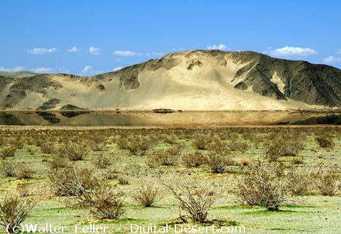
Elevation 1080'
< Previous <> Next >
clickable map