West Cronese Lake
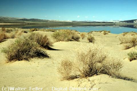
WEST CRONESE LAKE
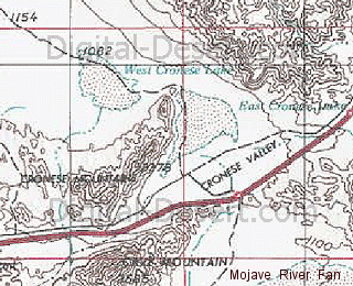
West Cronese Lake is a playa basin within the Cronese Basin complex of the ancestral Mojave River system. It represents one of the downstream basins that received water from the Mojave River after it exited Afton Canyon and crossed the Mojave River Fan.GEOGRAPHIC SETTING
West Cronese Lake lies within the Cronese Basin, alongside East Cronese Lake, in the central Mojave Desert. It occupies a low elevation depression where water accumulated during periods of sustained flow and lake expansion.The basin sits between the Mojave River Fan and the terminal basins of Soda Lake and Silver Lake, placing it in an intermediate position within the downstream lake chain.
ELEVATION
The surface elevation of West Cronese Lake is approximately 1,060 feet above sea level. This elevation reflects its role as a receiving basin that could store water before potential overflow into lower basins under high discharge conditions.HYDROLOGIC ROLE
During wetter climatic intervals, West Cronese Lake likely functioned as part of a connected chain of lakes extending from upstream basins toward Lake Mojave. Water entering the Cronese Basin would spread into both East and West Cronese basins, depending on flow volume, channel position, and local topography.At times of sufficient inflow, these basins may have filled and contributed to downstream movement of water toward Soda Lake and Silver Lake.
SIGNIFICANCE
West Cronese Lake illustrates the intermediate storage function of basins within the Mojave River system. It represents a stage in the progression from confined river flow to broad, distributary lake conditions across the desert.The playa surface preserves evidence of past lake conditions and contributes to the reconstruction of hydrologic connectivity within the ancestral Mojave River network.
< Previous
clickable map