Map of Historic Mojave Road
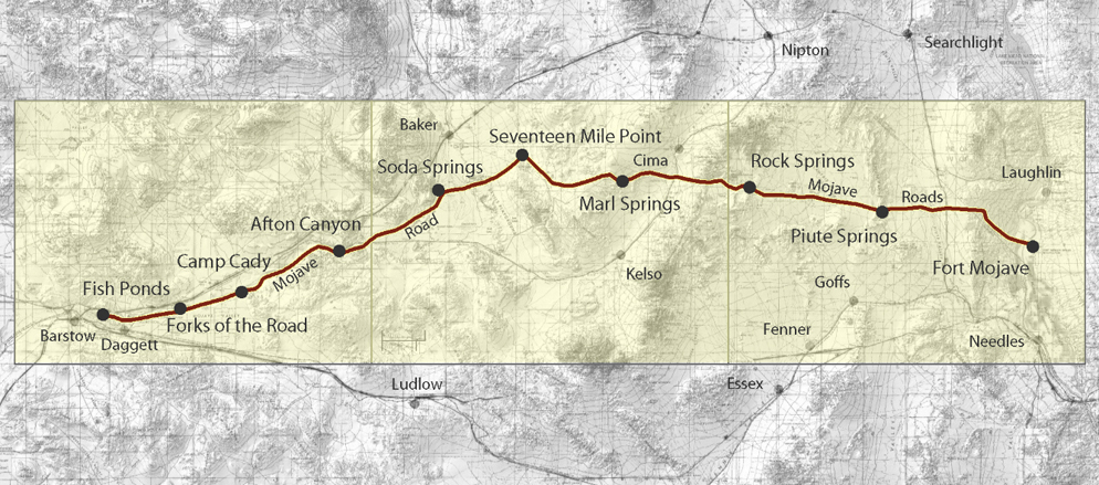
| Map 1 - Fish Ponds to Afton Canyon | Map 2 - Soda Springs to Marl Springs | Map 3 - Rock Springs to Fort Mojave |
The Mojave Road map is divided into three sections, tracing the historic trail from Fish Ponds near Barstow east across the desert to Fort Mojave on the Colorado River. Each section links to the springs, crossings, camps, landmarks, and other features along that part of the route.
The map follows the historic road from west to east. Modern driving tours usually begin at the Colorado River and travel west. They also include detours around sensitive areas and portions of the original trail that are no longer passable by motor vehicle.
This map is for historical purposes only and should not be used as a driving guide.