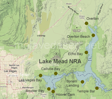
Overton Beach

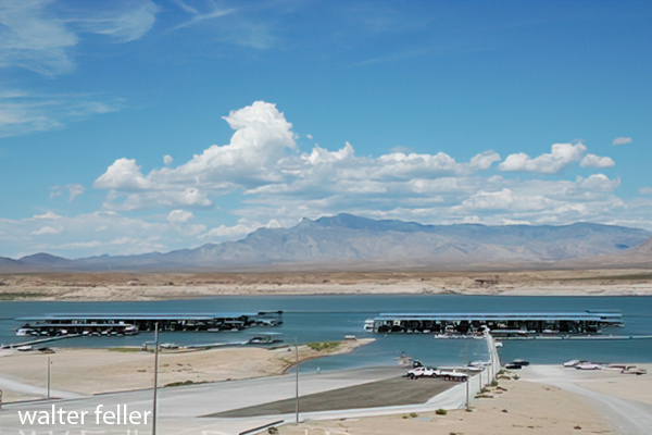
Overton Beach - 2004
In 1939, Overton Beach was one of the three National Park Service areas of the Boulder Dam National Recreation Area to have facilities.
Lost City
The Basketmaker Indians lived at Lost City, also called Pueblo Grande de Nevada, on the Muddy River near the Virgin River probably before 500 A.D. Pueblo Grande de Nevada, or Lost City, is an unfortunate choice of names, since it applies to the whole complex of villages scattered along the Virgin and Muddy Valleys.The Indians built pit houses and, later, two and three story houses. The earlier tribes hunted and gathered their food, while later people farmed extensively.
"Mesa House" is the term used for the last occupational period in the area. The people were living in a number of villages during the Mesa House period ca A.D. 1100-1150.
Surveys and excavations of Lost City began in 1924 under the Southwestern Museum, most of the work being done from 1935-1938. Many artifacts and reconstructed pueblo houses are now at the Lost City Museum in Overton.
St. Thomas
In 1865, the Mormons established St. Thomas, at the junction of the Muddy and Virgin Rivers. The colonists farmed, raised cotton, and worked with the Southern Paiutes.In 1912, there was enough business to have a railroad branch built to St. Thomas. The town became the halfway stopping point on the Old Arrowhead Trail, having a hotel, good meals, and a reliable garage.
But then the Hoover Dam project was started. Evacuation notices were posted on everything for five years, however no one left until rising water was spotted in the Virgin Canyon. Many of the buildings were moved to towns on higher ground.
Sometimes, when the lake gets low enough, buildings, dead trees, and rusted machinery can be seen.
Before the Water Rose
-
Starting as a pioneer settlement in 1865, St. Thomas grew to be an established town of farms, homes and stores. Life
passed slowly until Hoover Dam was built. St. Thomas was doomed as the rising waters of the Colorado River slowly filled
canyons and valleys, creating Lake Mead. The residents of St. Thomas sold their land, tore down homes that had been
lived in for generations and said goodbye to friends and neighbors. On June 11, 1938, Hugh Lord rowed away from his house,
the last citizen to leave. The community was soon covered by the lake, a victim of a rapidly changing landscape and lifestyle in the desert.
While we cannot bring St. Thomas back to life, we can show the town and its people the respect we’d like our home town to receive. Please do not climb on foundations or disturb any artifacts you find. These remnants remind us of the people of St. Thomas, those who played, worked and lived here.
The National Park Service protects and preserves more than 380 sites of cultural, historic and natural significance. From the stone dwellings at Mesa Verde to the Civil War battlefield at Gettysburg and here at the ruins of St. Thomas, we learn about those who lived before us.
Mountains of salt
Located three miles south of St. Thomas, on the west side of the Virgin, was the famous mountain of salt. This necessity, also found in many caves in the area, was probably the reason for the site of the Lost City.Over the years, it has grown in peoples imagination to fantastic proportions - 3 miles long, all salt, and that as clear as glass. Its names include Big Salt Cliff, Salvation Salt, Salt Point, and Salt Mountain.
Lake Mead waters now cover this huge salt deposit, as well as most of the caves.
source - NPS
