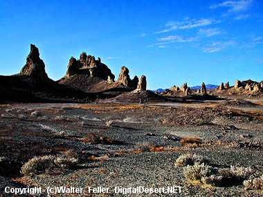
Trona Pinnacles
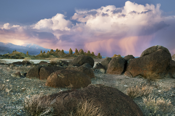
This eerie, fantastic landscape is one of the most
unique geological features in the California desert.
These other-worldly shapes are the Trona Pinnacles.
Known as
tufa
pinnacles, these strange shapes
formed underwater 10,000 to 100,000 years ago.
This portion of Searles Dry Lakebed is the bottom
of a long ago glacial lake. These over 500 pinnacles
are composed or primarily of calcium carbonate
with some blue-green algae thrown in.
The pinnacles are at an elevation of 1800 feet above
sea level in the western Mojave Desert,
18 miles from
Death Valley National Park.
The Slate Range is to the east. The city of
Trona
is
10 miles to the north along the base of the Argus Range.
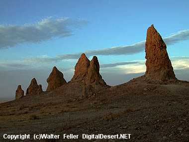
Formation of the Pinnacles
During the Pleistocene Ice Ages, massive
runoff spilled from the Sierra Nevada into
a chain of "inland seas." This system of
interconnected lakes stretched from
Mono Lake
to Death Valley and included Searles Lake.
Deep beneath Searles Lake, calcium-rich
groundwater and
alkaline
lake water combined to grow
tufa formations. Today you see the rare aftermath of
these perfect geological conditions. You can walk
right up to the pinnacles, which stand up to
140 feet tall and 40 feet wide.
Three Groups, Four Tufa Shapes
The Trona Pinnacles did not form all at the same time.
The pinnacles are divided by age and elevation into
three groups. The groups are dubbed the northern,
middle and southern groups because they formed during
three ice ages.
The northern group is the youngest at about 10,000 - 25,000
years old. These are the These are the best examples of
what are known as tufa towers. The northern youngsters
also include shapes called tombstones, ridges, and cones.
Close cousins to the northern group, the small middle
group claims only about 100 spires, but boasts
the tallest "tower," rising 140 feet. The granddaddy
of them all, the southern group, includes
roughly 200 tufa formations aged 32,000 to 100,000 years old.
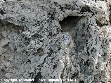
People have historically given names to the strange forms. These
ancient spires were once dubbed "Cathedral City". Geologically, the
pinnacles are classified into four general shapes. Towers are taller
than they are wide and rise 30 to 40 feet. Tombstones are stubby
and squat and rise 20 to 30 feet. Most tombstones are in the
northern-most tufa formations. Ridges are massive toothy tufa ruins. Trona
has three ridges, one in the northern tufa cluster and two in the middle
group. One ridge is 800 feet long and 500 feet wide and 140 feet tall. Cones
are less than 10 feet tall. Dumpy and mounded, cone shapes lay scattered
throughout the Trona Pinnacles.
The Trona Pinnacles were designated as a National Natural Landmark by the
U.S. Department of the Interior in 1968 to preserve one of North America's
most outstanding examples of tufa tower formation.
Humans at Trona Pinnacles
Items such as large, ancient spear points and atlatls (throwing sticks) suggest that humans have been here from at least 8,000 - 10,000 years ago. Bones from both the wooly mammoth and camel have been found around Searles Lake possibly indicating that early humans used the site for hunting and processing of food.

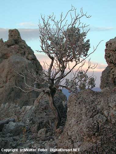
Survival in the Desert
Desert life is brutal. Organisms must endure temperatures
above 115F amd survive with under three inches of rainfall
a year. Plants such as the Desert Holly, a salt bush, clings to the basin
soils. Lichen creep along some of the pinnacles. The tufa
towers can also shelter nesting prairie falcons and
ravens.
Kit fox,
coyotes,
kangaroo rats,
desert iguanas,
horned lizards,
and sidewinder rattlesnakes live in the
sandy washes.
Source - BLM
FIELD GUIDE TO THE GEOLOGY OF THE WESTERN MOJAVE DESERT - BLM
Dr. Gregg Wilkerson
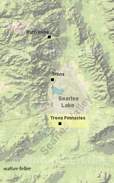
Zoom out to Searles Valley