--
Route 2
Alabama Hills
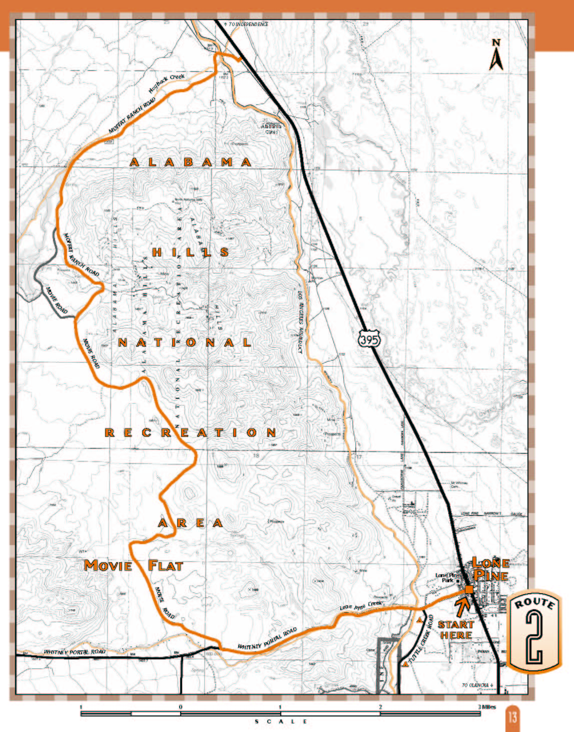
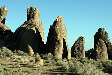
Bizarrely-shaped boulders and pinnacles of stone; behind them the snow-capped peaks of the High Sierra - No wonder the Alabama Hills have been the setting for hundreds of films - depicting deserts of the old west, the far east, and even distant galaxies!What to expect: Although it begins on pavement, most of this route is on a well-maintained graded dirt road that is usually accessible year-round.
Length: 12.1 miles.
Driving time: about 1 hour, one way.
Getting there: From
Lone Pine
start at the traffic light in the center of
town and turn west, toward the Sierra, onto Whitney Portal Road. The
route starts here at the intersectionset your trip meter to zero.
Along the route: About half a mile out of Lone Pine youll cross
the Los Angeles Aqueduct, completed in 1913 to supply water to the
incorporated City of Los Angeles. The solitary pine tree growing along
the creek above the aqueduct is close to the location of the original
lone pine that gave the creek and the town their name. The original
tree blew down in a wind storm in 1882.
Near the pine are an information kiosk and entrance sign for the
Alabama Hills Recreation Lands. The
mining district in these hills was named by
Confederate sympathizers in honor of the Confederate raider ship
Alabama, which sank over 50 Union ships in its 22-month existence.
The weird, picturesque rock formations of the Alabama Hills are
granite eroded by water into rounded shapes. The majestic High Sierra
backdrop is also eroded by water, but in the form of ice, which carves
and cracks granite into jagged crags. Which one is Mount Whitney,
highest peak in the contiguous 48 states? The cover of this
guide shows it in the center. It appears lower than
neighboring peaks because it stands farther back.
At 2.7 miles, at the white historical marker, take a
right turn off the paved road
onto Movie Road. It all
began in 1920 when Fatty
Arbuckle came here to film The Round Up for Paramount. Since then more than 300 films have been shot
in the Alabama Hills, along with dozens of TV shows, movie serials
and car commercials. Go to the right of the marker onto the graded dirt
road, which soon becomes rough pavement and then dirt again. Youll
be driving through Movie Flat, the location for many Western movies
with stars including John Wayne, Tom Mix, Gene Autry, Hopalong
Cassidy and Roy Rogers.
At 3.8 miles pull over, get out and look west toward the Sierra and
back to the south to see the exact Roy Rogers location shown in the
photo! If youre a movie buff, plan on coming back for the Lone Pine
Film Festival held here each October, when still photos from many
motion pictures are set up on location.
At 4.2 miles turn right and continue to follow the main, graded road.
At 5.4 miles, just past the crest of the hill, is where John Wayne made
his last appearance before the camera in a 1978 commercial.
At 7.9 miles make a right turn onto a road that is also graded but a
little more narrow and rough. This is Moffat Ranch Road, but there
may be no sign at this intersection. Moffat Ranch was the site of the
Salt Lake City set for the movie Brigham Young.
At 8.3 miles take a left, then immediately another left.
At 9.2 miles go right to follow along Hogback Creeka good place
to see and hear songbirds in the spring and early summer. As you
descend to the valley floor youll cross a cattle guard; take a right and
go over the aqueduct again to return to
U.S. 395.
.. Source - BLM
Alabama Hills
Owens Valley Ecology
Sierra Nevada Ecoregion:
Eastern Slopes Ecology
Basin and Range
Sierra Nevada
Alabama Hills Photos