--
Freeways and Highways
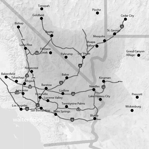
General area road map. Not all roads are shown.
Freeways and modern highways in the Mojave Desert have played a significant role in connecting various cities and facilitating transportation across the region. The desert landscape, known for its arid conditions and vast stretches of open space, presents unique challenges for building and maintaining road infrastructure.
One of the major freeways in the Mojave Desert is Interstate 15 (I-15), which runs from the southern border of California through several desert cities, including Barstow, Baker, and Primm. This freeway is a vital transportation route for residents, commuters, and tourists, linking major population centers such as Los Angeles and Las Vegas.
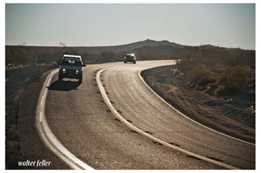
Another important freeway is Interstate 40 (I-40), which extends east-west through the Mojave Desert. This highway connects cities such as Needles, Barstow, and Ludlow, providing access to various attractions and natural wonders in the region. I-40 is known for its scenic drives, with stretches of road offering panoramic views of the desert landscape.
In addition to freeways, modern highways in the Mojave Desert include State Route 58 (SR-58) and State Route 127 (SR-127). SR-58 connects the city of Barstow to Bakersfield, serving as a crucial transportation link between the Mojave Desert and the Central Valley. SR-127, on the other hand, runs north-south through the eastern part of the desert, connecting Baker to the Nevada border.
The construction and maintenance of these freeways and highways in the Mojave Desert require careful planning and consideration of unique environmental conditions. Desert extreme temperatures, strong winds, and sandstorms challenge engineers and road crews. Special measures, such as incorporating desert-specific materials and reinforcement techniques, are taken to ensure roadway durability and safety.
Moreover, the desert's expansive landscape often requires long stretches of road without frequent exits or services. Rest areas and gas stations are strategically placed along the highways to provide essential amenities for travelers. These facilities offer a much-needed respite and serve as rest stops for drivers journeying through the Mojave Desert.
In conclusion, freeways and modern highways have transformed transportation in the Mojave Desert. They connect cities, linking regions and providing access to desert unique attractions. These roadways' careful planning and construction have overcome the challenges of the desert's arid conditions. This has made travel through the Mojave Desert more convenient and accessible for all.
Interstate 15
Interstate 40
U.S. 395
State Route 2
State Route 14
State Route 18
State Route 38
State Route 58
State Route 62
State Route 127
State Route 136
State Route 138
State Route 173
State Route 178
State Route 190
State Route 247
State Route 247 - Old Woman Springs Highway
