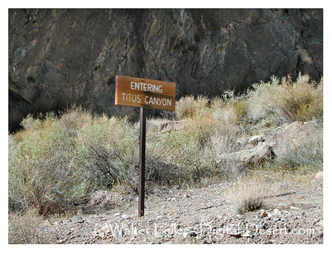
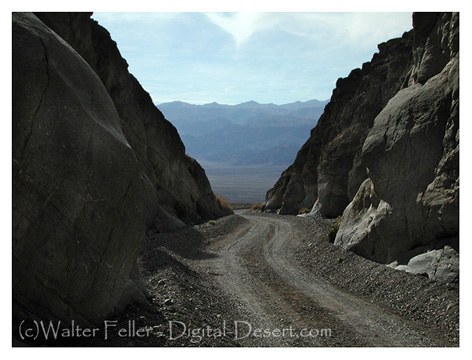
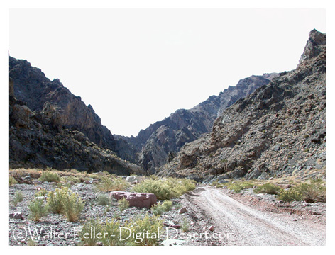
Digital-Desert : Mojave Desert Visit us on Facebook -- Desert Gazette -- Desert Link
Intro:: Nature:: Map:: Points of Interest:: Roads & Trails:: People & History:: Ghosts & Gold:: Communities:: BLOG:: Weather:: :?:: glossary
Death Valley National Park: Backcountry Roads:

Titus Canyon

Route #4
    Vehicle needed:
    high-clearance

    Distance:
    27 miles

    Start:
    Nevada Highway 374 (Daylight Pass Road), 2 miles east of park boundary

    Camping:
    no

    Description:
    This popular road is ONE-WAY from east to west. The road re-enters the park and winds through the Grapevine Mountains, then drops down through one of Death Valley’s most spectacular canyons. Along the way watch for the ghost town of Leadfield and petroglyphs at Klare Spring. Please report sightings of Bighorn Sheep to the visitor center. A free information handout describing the trip highlights can be picked up at the visitor center.
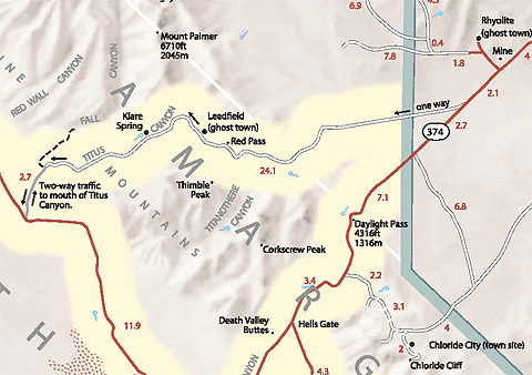
Titus Canyon

Titus Canyon Geology


Intro:: Nature:: Map:: Points of Interest:: Roads & Trails:: People & History:: Ghosts & Gold:: Communities:: BLOG:: Weather:: :?:: glossary
Country Life Realty
Wrightwood, Ca.
Mountain Hardware
Wrightwood, Ca.
Canyon Cartography
DesertLink
Links to Desert Museums

Grizzly Cafe
Family Dining


Custom Search

AbeBooks
Abraxas Engineering
privacy
These items are historical in scope and are intended for educational purposes only; they are not meant as an aid for travel planning.
Copyright ©Walter Feller. 1995-2023 - All rights reserved.