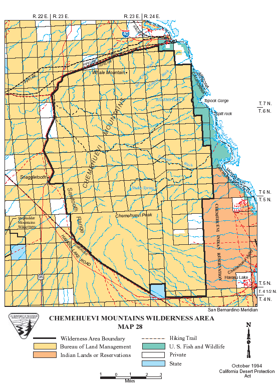
Digital-Desert : Mojave Desert Visit us on Facebook -- Desert Gazette -- Desert Link
Intro:: Nature:: Map:: Points of Interest:: Roads & Trails:: People & History:: Ghosts & Gold:: Communities:: BLOG:: Weather:: :?:: glossary

Wilderness - MAP
Whipple Mountains >> Map #27

Whipple Mountains Wilderness

SIZE: 77,520 acres

LOCATION: San Bernardino County; 10 miles northwest of Parker, Arizona

ACCESS: Access to the eastern boundary of the wilderness is by four-wheel drive vehicle on a powerline road. Start at Parker Dam on the Colorado River and go south on the California side to Black Meadow Landing Road (less than a mile). Take this paved road 6 miles to the dirt road that leads to Havasu Palms. Follow this route for 2.1 miles to the powerline road, which for the next 8 miles, forms the eastern boundary of the wilderness.

Intro:: Nature:: Map:: Points of Interest:: Roads & Trails:: People & History:: Ghosts & Gold:: Communities:: BLOG:: Weather:: :?:: glossary
Country Life Realty
Wrightwood, Ca.
Mountain Hardware
Wrightwood, Ca.
Canyon Cartography
DesertLink
Links to Desert Museums

Grizzly Cafe
Family Dining


Custom Search

AbeBooks
Abraxas Engineering
privacy
These items are historical in scope and are intended for educational purposes only; they are not meant as an aid for travel planning.
Copyright ©Walter Feller. 1995-2023 - All rights reserved.