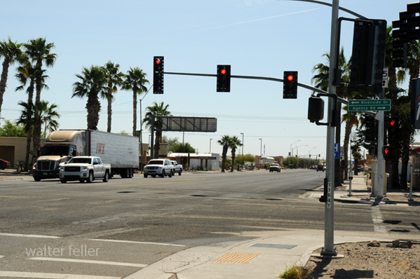
Parker, Arizona
The Town of Parker is located within the northern corner of the Colorado River Indian Tribe reservation on a mesa overlooking the Colorado River at an elevation of approximately 450 feet above sea level. The Town of Parker is within the Sonora Desert located near river bottomland and rugged low desert mountains. The Gibraltar Mountains lie east of the community while the Whipple and Riverside Mountains lie to the north and southwest respectively. The Colorado River Indian Tribe reservation straddles the Colorado River from a point five miles north of Parker to a point 50 miles south and contains over 264,000 acres. The reservation was established for all Native Americans living along the river by act of Congress, approved by the President on March 3, 1865. The Tribes represented on the Reservation are the Mohave, Chemehuevis, Navajos, and Hopi. The original town site of Parker was surveyed and laid out in 1908 by William Shrover. The Town’s name and origin began when a post office was established January 6, 1871, on the Colorado River Indian reservation to serve the Indian agency. The post office was named Parker in honor of General Eli Parker who was Commissioner of Indian Affairs when the Colorado River Indian reservation was established by Congress in 1865.
wf.jpg)
First passenger train to cross the bridge in 1907 (colorized)
A railroad was laid in its present location in 1905, and Parker post office was moved upstream four miles to the railroad. Since the town site of Parker was laid out for the purpose of providing a railroad stopover, watering and shipping station, it was only logical that the railroad would run through the center of the Town. The Town was laid out on a grid of 100 –foot streets forming 300 x 4000 foot blocks with twelve 50- foot wide lots to a block. The Federal Government auctioned off lots in 1910.
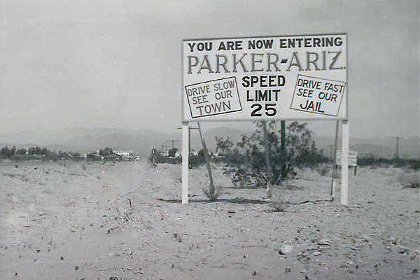
1930s real estate sign
Agricultural development, which is the present economical mainstay of the area, commenced on March 2, 1867, when Congress appropriated $50,000 for the Indians’ irrigation system. This money was used for the construction of the Grant-Dent canal from 1867 to 1871. Early irrigated farming was dismal and painstaking – banks washed away, canal caved in, wells served up alkali water, river flooding washed out new construction and equipment. However, these early failures did not discourage those who had visions of a great agricultural empire. By 1914 only 600 acres of Indian-owned land were being irrigated and inadequate drainage was water logging the majority of those acres. At this time, the Town of Parker had a population of 90, and the principal economic activity of the Town was a service and shipping center for agriculture and mining activities scattered throughout the area.
Regardless of the frustrations and problems connected with irrigation, agricultural activity on the reservation continued to expand while mining activity slackened. In 1936, over 5,000 acres of river bottomland were under irrigation. By 1941, when Headgate Rock Dam was constructed, there were 10,5000 acres of land under cultivation, and the guaranteed water level provided by the dam accelerated agricultural expansion. By 1955, 38,000 acres had been cleared for farming. During the time the Town of Parker took on the importance and character of a small agricultural service and shipping center. While Headgate Rock Dam ensure a controllable river water level, agricultural expansion proceeded at a rather fast pace. However, farming was plagued by high water tables, improper drainage and excessive salts rendering hundreds of acres useless for farming. This problem was resolved over the next seven years, and by 1963, land under cultivation accounted for 34,000 acres. Cotton became the big crop, and cotton gins were constructed in the Town of Parker. Between 1914 and 1937 Parker existed as a small community providing supplies and services to the agricultural and mining operations of the area, and in the late 1930’s it provided community facilities to the construction and administrative people working on federal projects along the Colorado River. After World War II, tourists, sportsmen, and winter residents also became attracted to the smooth waters behind Headgate Rock Dam.
In 1937, a highway bridge was completed across the Colorado River connecting Arizona to California, thus ending the ferry service that had been in operation for 27 years by Joe Bush and his wife, Nellie T. In 1928, Parker Dam was completed, thus ensuring better water control of the river and creating a lake approximately 700 feet wide and 16 miles long called Lake Moovalya, and Indian word meaning “blue water”. Thus the creation of, and ease of access to Lake Moovalya changed the character of the Town of Parker to some extent from a service center for agricultural and mining workers to one of providing supplies and services to tourists, fishermen, hunters, and boat enthusiasts. Due to the inability to provide long-term leases, agricultural expansion of Indian Reservation lands had come to a standstill. In 1962, Congress granted the right to make 99-year non-agricultural leases of Indian Reservation lands and early in 1963 provided the right to make 25-year agricultural development leases. On June 3, 1963, the U.S. Supreme Court decreed that the Colorado River Indian Reservation shall be entitled to enough water to irrigate 107,588 acres of agricultural land.
The Town of Parker officially incorporated as a town in 1948. In 1980, Parker annexed 13,000 acres of non-contiguous land ten miles to the southeast known as Parker South. In May 1982, by initiative petition, voters formed La Paz County from the northern portion of Yuma County. On January 1, 1983, Parker became the county seat for La Paz County.
Town of Parker, Arizona
https://www.thetownofparkeraz.com/history.html
Parker Strip Recreation Area
Back country byways traverse scenic corridors that are off the beaten path. The Parker Dam Road "Thread of Life" highlights the scenic, natural, historic, and prehistoric values along an11 mile (18 km) road that travels along the California shore of the Colorado River. This area has attracted people, wildlife, and vegetation along a linear oasis, creating the Thread of Life.The byway provides an abundance of recreation activities including camping, swimming, boating, fishing, rock hounding, hiking, OHV play areas and wildlife viewing. (BLM)