-.-
Deep Creek
DEEP CREEK
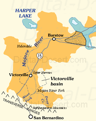
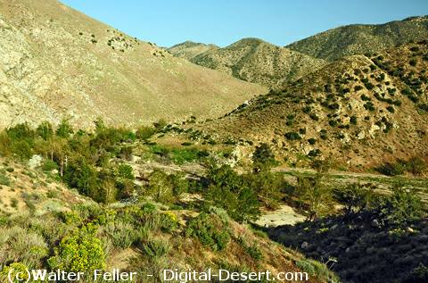
Deep Creek is the primary collection channel for the eastern portion of the upper watershed of the Mojave River system. It originates in the San Bernardino Mountains and serves as one of the two principal headwater branches that form the Mojave River.GEOGRAPHIC SETTING
Deep Creek drains the eastern slopes of the San Bernardino Mountains, where precipitation and snowmelt are concentrated at higher elevations. Numerous smaller tributaries and mountain streams converge into Deep Creek, forming a well defined channel that carries water northward out of the range.As it leaves the mountainous terrain, Deep Creek flows toward the Victorville Basin, where it eventually meets the West Fork at the Mojave River confluence.
HYDROLOGIC FUNCTION
Deep Creek functions as the main drainage conduit for the eastern headwaters of the Mojave River system. Its flow is driven by seasonal precipitation patterns, including winter storms and spring snowmelt.Because the San Bernardino Mountains receive the majority of precipitation within the basin, Deep Creek plays a critical role in delivering water to the Mojave River. During periods of high runoff, it can carry substantial discharge into the downstream system.
SYSTEM ROLE
At the confluence with the West Fork, Deep Creek combines with western tributary flows to form the Mojave River. This junction marks the transition from separate mountain drainage systems to a unified river channel.Deep Creek represents the eastern counterpart to the West Fork, together establishing the primary flow that continues through the Mojave Desert.
SIGNIFICANCE
Deep Creek is essential to the hydrology of the Mojave River, acting as the principal collector of water from the eastern San Bernardino Mountains. Its role in concentrating and delivering runoff makes it a foundational component of the entire river system.< Previous <> Next >