Geology Tour Road:
Stop #13
Pleasant Valley Dry Lake
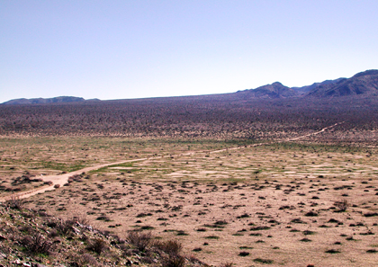
Looking south across the playa
The upheaval of the Hexie Mountains with subsidence of the area north of the southern fault line, created a low area in which a periodic lake existed during a wetter climate. Sediments made of clays and sand were carried from nearby slopes and alluvial fans to be deposited at depths of several hundred feet. As time went on, and the lakebed rose, the slope extending from the canyons and alluvial deposits lessened. With this, finer silts and dissolved salts drying began to level the bottom of the valley creating what we see now as a dry lake, or playa. Although salt deposits here are not as obvious as in other desert dry lakes (where extremely few, or, no plants grow), evidence of the salt content can be seen in the presence of salt-tolerant plants species. Interestingly, after heavy rains, many dry lakes become temporary "wet" lakes.
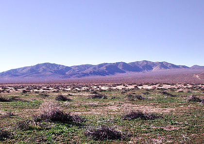
Looking west across the playa
PREVIOUS - NEXT
| GLOSSARY | > alluvial fan, dry lake, fault, playa, sediments |
Dry Lakes of the Mojave
In desert basins, where rivers merge but do not drain, a dry lake bed or playa may ...