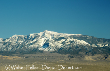
Telescope Peak
Telescope Peak: The Roof of Death Valley
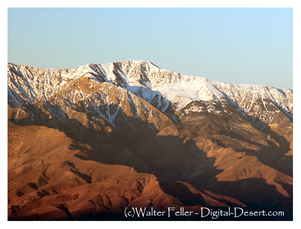
If you want to understand the true extremes of Death Valley, youve got to climb Telescope Peak. At 11,049 feet, its not just the highest point in the parkits a full vertical two miles above Badwater Basin, the lowest spot in North America. Thats a dramatic difference you can actually feel in your lungs, legs, and even your soul as you make your way up the trail.
The hike to the summit starts at Mahogany Flat Campground, tucked into the upper reaches of the Panamint Range. Getting there takes a bit of doingEmigrant Canyon Road winds its way up from the valley floor, and the last stretch to the campground is rough enough that a high-clearance or 4x4 vehicle is usually needed. That rugged access keeps the crowds down and the wilderness feel intact.
The trail itself is no walk in the parkits a 13- to 14-mile round trip with around 3,000 feet of elevation gain. Its listed as strenuous for good reason. But with each step, the landscape changes in a way thats both surprising and beautiful. Youll pass from pinyon-juniper woodland into groves of ancient bristlecone pinestrees that have stood on this mountainside for thousands of years, their twisted trunks holding onto secrets older than most civilizations.
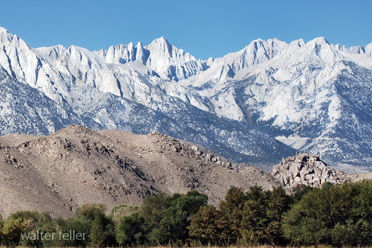
As you climb higher, the views begin to stretch further. On clear days, you can see Mount Whitney to the westanother extreme, being the tallest mountain in the lower 48. Look east, and Charleston Peak rises beyond Las Vegas. But its the view straight down that really gets you: the salt flats of Badwater Basin glittering far below, making you feel like youve climbed to the top of a continent.
Theres no water on the trail, so youll need to bring all youll need. And weather can be ficklehot at the bottom, snow-dusted at the top, even in spring or fall. Still, for all the effort, theres something timeless about standing on that summit. It's the kind of place that doesn't just offer a view, but a shift in perspective.
Not far from the trailhead are the Wildrose Charcoal Kilnsodd-looking beehive-shaped structures built in 1877 to produce charcoal for smelters in the mining camps beyond. They stand as silent reminders of another kind of climbone powered not by hiking boots, but by mule teams and grit, back when these mountains were measured more in ore than in scenery.
Telescope Peak isnt just a hikeits a journey through contrasts. From the hottest place in North America to a breezy alpine ridge, from dry desert shrubs to ancient trees older than history, its a reminder that Death Valley holds much more than heat and emptiness. It holds altitude, solitude, and stories told by the land itself.
Panamint Range
The Panamint Range is aligned north-south. The elevation range is from about 1000 feet up to 11049 feet on Telescope Peak ...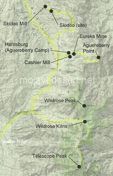
| Skidoo Mill | Skidoo (site) | Harrisburg |
| Eureka Mine | Cashier Mill | Aguereberry Point |
| Wildrose Kilns | Wildrose Peak | Telescope Peak |
Ecology: Panamint Range - 341Ff
Regional Geology: Northern Panamint Region
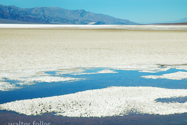
Badwater
Mt. Whitney