Digital-Desert : Mojave Desert Visit us on Facebook -- Desert Gazette -- Desert Link
Intro:: Nature:: Map:: Points of Interest:: Roads & Trails:: People & History:: Ghosts & Gold:: Communities:: BLOG:: Weather:: :?:: glossary

Wilderness - MAP
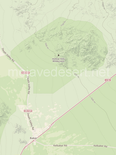
Hollow Hills >> Map #42

Hollow Hills Wilderness

SIZE: 22,240 acres

LOCATION: San Bernardino County ; 4 miles north of Baker, California

Hollow Hills Wilderness photo

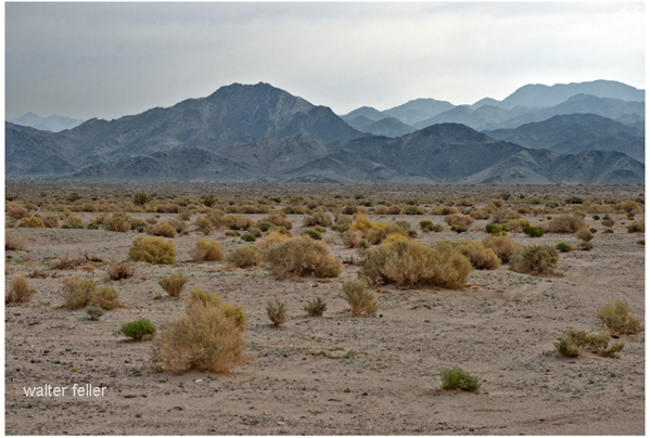
NATURAL RESOURCES: A gentle bajada interlaced with washes slopes to the west toward Silver Dry Lake. To the east, low rolling hills lead to the Turquoise Mountains, a gentle range with smooth ridges and rounded peaks. Elevations range from 300 feet on the west to a central summit of 3,122 feet. The Hollow Hills Wilderness contains plains, hills and alluvial fans typical of the California desert. Desert tortoise and Mojave fringe-toed lizard have been seen here. Creosote, desert holly and scale scrub plant communities prevail throughout this area.

GLOSSARY > alluvial fan, bajada, dry lake, wash


map of Hollow Hills Wilderness

Access this wilderness from:
State Highway 127.

Subsection 322Ai:
Silurian Valley - Devil’s Playground

Intro:: Nature:: Map:: Points of Interest:: Roads & Trails:: People & History:: Ghosts & Gold:: Communities:: BLOG:: Weather:: :?:: glossary
Country Life Realty
Wrightwood, Ca.
Mountain Hardware
Wrightwood, Ca.
Canyon Cartography
DesertLink
Links to Desert Museums

Grizzly Cafe
Family Dining


Custom Search

AbeBooks
Abraxas Engineering
privacy
These items are historical in scope and are intended for educational purposes only; they are not meant as an aid for travel planning.
Copyright ©Walter Feller. 1995-2023 - All rights reserved.