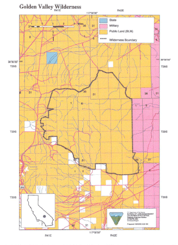
Golden Valley >> Map #41
Golden Valley Wilderness
SIZE: 37,700 acres
LOCATION: San Bernardino County; 10 miles southeast of Ridgecrest, California
NATURAL RESOURCES: The Golden Valley, for which this wilderness is named, is surrounded on either side by two distinct mountain ranges. The Lava Mountains stretch across the northwestern portion of the area, crowned by Dome Mountain at nearly 5,000 feet. This range is cut by several steep walled canyons that reveal bands of multi-colored sedimentary rocks. The Almond Mountains, rising to an elevation of 4,500 feet, enclose the valley on the southeast. Golden Valley, which is known for its spectacular spring floral displays, lies between the two ranges. The ruggedness of these mountains have helped shelter the valley from human intrusion. The wilderness provides nesting and foraging habitat for raptors and habitat for the desert tortoise and Mojave ground squirrel. Vegetation consists primarily of a creosote bush scrub community with Joshua trees and numerous annuals.
| GLOSSARY | > canyon, lava, sedimentary |
ACCESS: Access this wilderness via U.S. Highway 395 and along the Red Mountain-Trona Road 1 mile north of Red Mountain to Steam Well Road (RM1444) on the south or Savoy Road on the north.