Digital-Desert : Mojave Desert Desert Gazette
True Facts, Legends & Lies
features - ecology: wildlife - plants - places - region map - map/sat - roads & trails - wilderness - video - aerial - 360 - old west - communities - books - lodging
route 66 - ghost towns - gold mines - parks & ... - joshua tree - death valley - mojave preserve - native culture - history - natural features - geology - glossary - comments

Wilderness - MAP
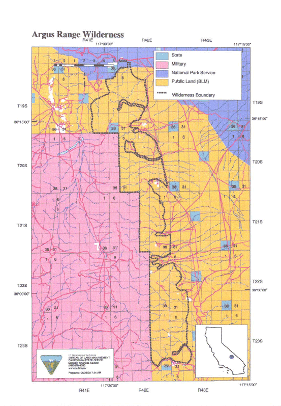
Argus Range >> Map #55

Argus Range Wilderness

SIZE:74,890 acres

LOCATION: Inyo County; 5 miles east of Darwin, California and 25 miles northeast of Ridgecrest, California

ACCESS: Access this wilderness via State Highways 190 or 178 to Panamint Valley Road through Panamint Valley. Numerous four wheel drive routes turn off Nadeau Trail providing access to canyons on the east side. On the south side, access is via Homewood Canyon off State Highway 178.


features - ecology: wildlife - plants - places - region map - map/sat - roads & trails - wilderness - video - aerial - 360 - old west - communities - books - lodging
route 66 - ghost towns - gold mines - parks & ... - joshua tree - death valley - mojave preserve - native culture - history - natural features - geology - glossary - comments
Wrightwood Real Estate
MOUNTAIN HOMES & CABINS
Vacation Rentals & Homes for Sale
Log Cabin Furnishings
Lodgepole Pine Log Furniture
Rustic Decor & Silhouette Metal Art
HighDesertRED.com
High Desert Real Estate Directory
--
Google
Search:
Keywords:
Check out our...
>> RECOMMENDED BOOK LISTS <<
Digital-Desert
Abraxas Engineering
privacy
Copyright ©Walter Feller. All rights reserved.
Respect U.S and international copyright statutes and our right to own and control our work
- DO NOT LINK TO THESE IMAGES FROM WEB PAGES, FORUMS OR BLOGS -
Desert Gazette