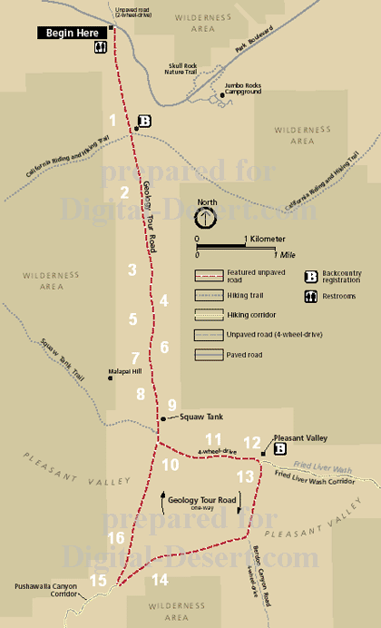
Geology Tour Road
The Geology Tour Road is an 18-mile, self-guiding driving tour along a dirt road winding through some of the park's most fascinating rockscape. 4-wheel-drive vehicles are recommended beyond stop #9, Squaw Tank.To continue, please start with the Introduction, or click Begin Here on the map.
Introduction
The face of the earth at any time represents only a fleeting moment in a very long ...
-
1_ Queen Valley
-
Queen Valley, a mountain-rimmed valley at an elevation of 4,450 feet is ...
2_ A Raindrop Divides
-
This knoll is the north-south drainage divide for the park. Typically, ...
3_ Nature's Gutter
-
This is a dry intermittant stream channel, more commonly known as a ...
4_ Old Erosional Level
-
Many of the monzogranite boulders here bear a distinct ...
5_ Rock Piles
-
The monzogranite forming these rock piles was once a ...
6_ Rock Sculpture
-
The White Tank monzogranite found at Joshua Tree National Park ...
7_ Malapai Hill
-
The twin peaks of Malapai Hill rise about 400 feet above the ...
8_ Alluvial Fans and Bajadas
-
Alluvial fans are made up of sand, gravel and rock which ...
9_ Squaw Tank
-
Squaw Tank is an excellent place to observe interesting ...
10 Pleasant Valley
-
The Blue Cut fault is an earthquake fault that runs for about ...
11 Debris Flow
-
Occuring at the mouth of this steep canyon in the Hexie Mountains,...
12 Mines
-
The Hexie Mountains slopes are riddled with mine tunnels ...
13 Dry Lake
-
The upheaval of the Hexie Mountains with subsidence of ...
14 Pinto Gneiss
-
The banded and folded Pinto gneiss, approximately ...
15 Pinyon Well Junction
-
This is the alluvial fan at the upper end of the bajada ...
16 Panoramic View
-
In this tour of the Queen and Pleasant Valley's, we've seen ...
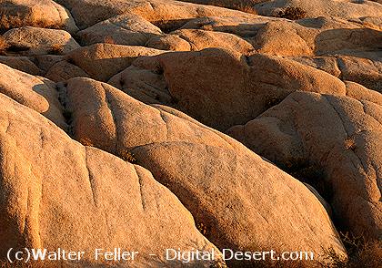
Squaw Tank granite