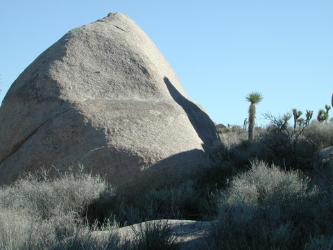
Digital-Desert : Mojave Desert Visit us on Facebook -- Desert Gazette -- Desert Link
Intro:: Nature:: Map:: Points of Interest:: Roads & Trails:: People & History:: Ghosts & Gold:: Communities:: BLOG:: Weather:: :?:: glossary

Geology Tour Road:

Stop #4

Old Erosional Level


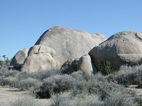
Many of the monzogranite boulders here bear a distinct groove about seven feet above the ground level. The sides of the boulders are generally steeper above this line than below it. This line indicates where a stable soil existed, protecting the bottom of the boulder from erosional forces during a wetter climate. Afterwards, during a drier climate, the soil surface eroded more rapidly. During this period there has not been nearly as much time for the lower surfaces of the boulder to weather, so the surfaces below the old soil level are not so steep.


PREVIOUS - NEXT

GLOSSARY > erosion, weathering
Clickable map


Intro:: Nature:: Map:: Points of Interest:: Roads & Trails:: People & History:: Ghosts & Gold:: Communities:: BLOG:: Weather:: :?:: glossary
Country Life Realty
Wrightwood, Ca.
Mountain Hardware
Wrightwood, Ca.
Canyon Cartography
DesertLink
Links to Desert Museums

Grizzly Cafe
Family Dining


Custom Search

AbeBooks
Abraxas Engineering
privacy
These items are historical in scope and are intended for educational purposes only; they are not meant as an aid for travel planning.
Copyright ©Walter Feller. 1995-2023 - All rights reserved.