Geology Tour Road:
Stop #10
Pleasant Valley
The Blue Cut fault is an earthquake fault that runs for about 50 miles through the Little San Bernardino Mountains, under Pleasant Valley, and into the Pinto Basin. It is named after the Blue Grandiorite exposed on the mountains at the southwestern edge of Pleasant Valley, the main branch of the fault.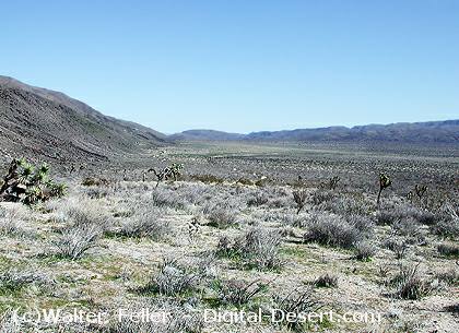
Pleasant Valley - looking east
The Hexie Mountains were pushed up from the northern branch of the fault to form the steep, straight southern edge of this range of gneiss. The land to the south, between the two branches, dropped down and subsided to create the depression that became the Pleasant Valley.
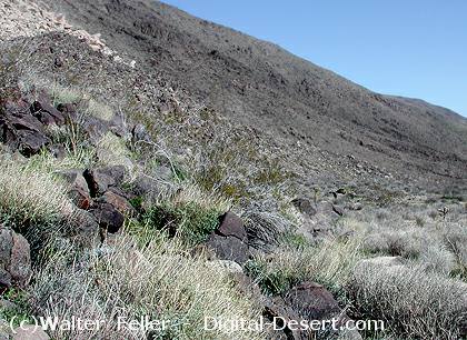
Desert varnish
Patina
The dark rocks at the end of the Hexie range are coated with a patina. Known as "desert varnish," this coating is composed of clay, iron and manganese oxides. Accumulation of this patina happens at an incredibly slow rate over thousands of years. The layers of patina can be read by scientists investigating climatic changes over these thousands of years.
PREVIOUS - NEXT
| GLOSSARY | > fault, desert varnish, gneiss, patina |