Salt Creek
CD2. Location/Access:(36o 35.436N, 116o 59.444W) The turnoff to Salt Creek is located on the west side of CA 190, 13.5 miles north of Furnace Creek or 11.5 miles southeast of Stovepipe Wells. The dirt road leading from the turnoff to the parking area is 1.2 miles long, flat, and well-graded gravel. On occasion it is closed due to flooding.
Best Time: Anytime, all year. However, the pupfish can best be seen in the spring.
Geology: Salt Creek is a small, short permanent stream with highly variable discharge that has its origin in springs upstream from the parking area but south of the sand dunes and Devils Cornfield east of Stovepipe Wells (Miller & Wright, 2004). The hills form a small anticline that has been cut by a fault on the northwest side (Wright & Troxel, 1993). This fault no doubt plays a role in controlling the location of the springs and may be related to the main trace of the Death Valley-Furnace Creek fault zone which lies just east of here. Salt Creek is the home of another species of pupfish, Cyprinodon salinus which has speciated since the Pleistocene from the pupfish at Saratoga Springs (Site FS2), Devils Hole (Site O1) and other locations throughout the Great Basin. Their common ancestor must have been swimming about in Lake Manly thus establishing the connection not only to sites in Death Valley but many of the other connected lakes within the Great Basin, Mojave Desert, Salton Trough and even the Sonoran Desert of southwest Arizona. See Snyder, et. Al. (1964) for the classic map of these Pleistocene Lakes.
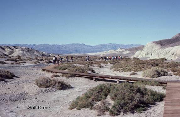
Salt Creek Interpretive Trail
Boardwalk along small stream. Good for viewing rare pupfish and other wildlife. Best in late winter/early spring. ...Photos of Salt Creek
At the bottom of Cottonball Basin runs Salt Creek, home of the rare ...=-=