Geology of the Death Valley Region
A VIRTUAL FIELD TRIP & GUIDEThe Far South (FS)
 The three sites in this area lie in the extreme southeast corner of Death Valley National Park immediately west of California Highway 127 which provides the best access ...
-
Amargosa River Crossing,
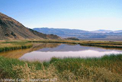
Saratoga Springs,
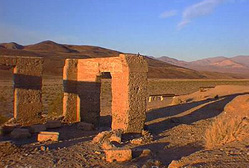
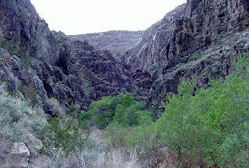
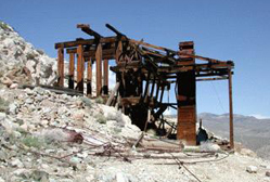
Ibex Springs/Talc Mines
Southeast (SE)
 These sites are all outside of Death Valley National Park and can be reached easily from Shoshone.
-
Dumont Dunes,
Sperry Wash,
Shoshone Road Cut,
Emigrant Pass,
Noonday Dolomite Worm Tubes,
Shoshone Fossil Footprints
Southern Central Region (SC)
 These sites offer a great variety of geology from mining to Pleistocene features to current and past tectonic processes. ...
-
Ashford Mill & Shoreline Butte,
Amargosa Chaos,
Split Cinder Cone,
Warm Springs Talc Mines,
Butte Valley
Badwater Region (BW)
 Most of these sites contain features of tectonic, topographic or geomorphic significance. ...
-
Detachment Fault,
Mormon Point,
Badwater,
Natural Bridge,
Devils Golf Course,
Artists Palette,
Mushroom Rock/Lake Manly Terrace,
Hanaupah Canyon Fault Scarp
Furnace Creek Wash (FC)
 Sites FC1-5 are located just southeast of the central headquarters and village area of ...
-
Echo Canyon,
Zabriskie Point/20 Mule Team Canyon,
Hole-in-the-Wall,
Billie Mine/Ryan,
Dantes View
Central Death Valley (CD)
 Sites CD1-5 are generally located between Furnace Creek and Stovepipe Wells and all are ...
-
Harmony Borax Works,
Salt Creek,
Manly Gravel Bar,
Keane Wonder Mine,
Boundary Canyon Detachment Fault
Grapevine/Northern Funeral Mountains (GF)
 Sites GF1-2 can both be accessed off the paved highway from Death Valley to Beatty, Nevada. Chloride Cliff provides ...
-
Chloride Cliff,
Titus Canyon,
Rhyolite,
North-Central Death Valley Fault Zone
Northern Panamint Region (NP)
 Sites NP1-10 are all located in the northern Panamint Mountains or within an easy drive of the village of Stovepipe Wells. ...
-
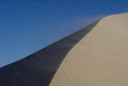
Stovepipe Wells Dune Field,
Grotto Canyon,
Mosaic Canyon,
Cottonwood Canyon,
Skidoo,
Aguereberry Point,
Stretch Pebble Conglomerate,
Charcoal Kilns/Mahogany Flat,
Wildrose Townsite,
Wildrose Graben
Panamint Springs Area (PS)
 This whole region was added to Death Valley National Park in 1994 when Death Valley was converted from the smaller ...
-
Father Crowley Viewpoint,
Darwin Canyon
Ballarat Area (BA)
These two sites are very easy to access. The roads are gravel but they are level and well graded.-
Ballarat Delta,
Briggs Mine
Cottonwood Mountains (CM)
 Sites CM1-7 offer some of the most unusual and visually rewarding locations within Death Valley National Park. ...
-
Ubehebe Crater,
Racetrack Playa (Includes Bonnie Claire Bonus),
White Cap Mountain,
Hunter Mountain,
Lost Burro Mine,
Goldbelt,
South Pass
Saline Valley (SV)
 One needs to be in a particular mood to visit the Saline Valley. The access is long, often rough, sometimes washed out by ...
-
Waucoba Springs,
Warm Spring,
Turtleback & Folding
The Far North (FN)
 Sites FN1-7 can be reached off the main road between Big Pine, California and the ...
-
Big Sand Spring,
Crater Mine,
Eureka Valley View,
Eureka Sand Dunes,
Cucomongo Wash,
Thrust,
Eureka Dunes Debris Flow
Outlier
References CitedCALIFORNIA & NEVADA
A VIRTUAL FIELD TRIP & GUIDE
Geology Program
Department of Earth, Space and Aviation Sciences
Palomar College
Geology: Steve Spear
Photography: Steve Spear, Eric Fishell, Randy Cook
Image Processing: Forest Fortescue, Steve Spear
GPS Data: Steve Spear, Randy Cook, Eric Fishell
Satellite Map: Wing Cheung
Introduction
Death Valley is perhaps the most geologically diverse region in the world. In terms of petrology, landforms, geologic structures, stratigraphy and tectonic history, the region has geologic variety matched only by its geographic extremes of topography and climate. As such, the Death Valley area has been a popular destination for geology field trips for many years. There are many geologic guides available for the Death Valley region that range from extremely technical refereed journal articles to pamphlets written for the general public. We have attempted to summarize this information as well as include some information not always found in other guides. First, since the advent of GPS tracking devices, the exact location of a particular geologic feature is easy to locate. Secondly, color photographs are now easily transmitted via computer. Thirdly, detailed location descriptions should also include timing and access information for the best time (in terms of weather and lighting) and route to visit a particular site. This virtual field trip and guide is an attempt to offer these last items for some of the better geologic sites in and around Death Valley National Park. Thus each location described is given the latitude and longitude in degrees and minutes, road directions, best time of day and year to visit, an explanation of what is there, a photograph of the site and a few pertinent references.
We have been using many of these sites for field trips for our students for many years. Others have been added because research by many of the authors cited in the references has revealed their significance only in recent years. The references cited for each are not meant to be exhaustive. We have tried to list references that should generally be obtainable at any university library. For a general overview of the geology of Death Valley, we recommend Wright and Miller (2004), Miller and Wright (2004), the Death Valley National Park website, and Sharp and Glasner (1997). For more detail on each selected site, please refer to the references cited for many of the locations.
The organization of the site descriptions generally starts in the far south of the national park and then proceeds north. We have provided mileages to each site from major, easily locatable landmarks such as towns and major road intersections. Latitude and longitude locations are given in degrees, minutes and decimals of minutes rather than seconds because that is the system that seems to be used by most people navigating in their vehicles using GPS. Speaking of vehicles, some of these sites are quite remote from pavement and thus if any high clearance or four-wheel-drive vehicle is needed, it is so noted this in the description.
To best use this guide in the field, one will need a good map. We recommend the Automobile Clubs Death Valley National Park Map. Also, the Trails Illustrated and other topography-based general maps are also very useful. While most of the locations are obvious once you are within a few hundred yards, the GPS coordinates will help you find the location more precisely if you are unsure of what youre looking for. Of course, with the GPS coordinates, one can input the data into a good mapping program and obtain an exact location. Many will prefer this method. The National Park Services Death Valley Website contains some good information on geology (there is a joint USGS field trip available) and this site is most useful for current road information. We have included a very general satellite map with the site locations at the end of the website after the references.
Special thanks are due to the following people who pointed things out to us in the field or otherwise: Tom Clements, Bill Fischer, Carl Hansen, Robert Pease, Bob Reynolds, Larry Spear, Zeke Snow, Dick Stone, Alan Swarm, Bennie Troxel, Brian Wernicke, and Lauren Wright.
General Regional Notes: