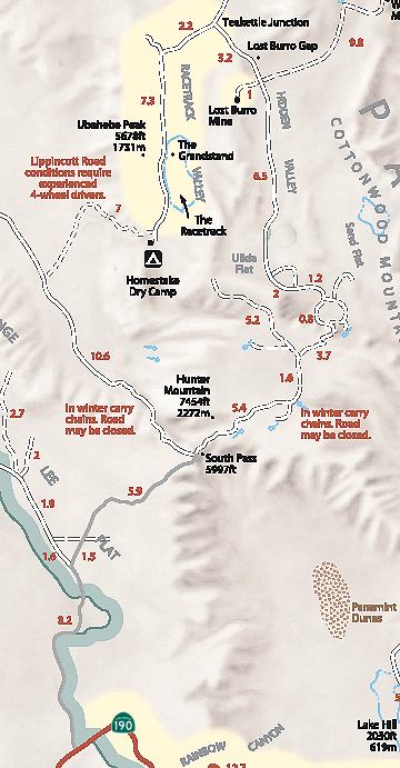
Hunter Mountain and Hidden Valley
Route #7-
Vehicle needed:
high-clearance to Hidden Valley; 4x4 recommended over Hunter Mountain
Distance:
40 miles from Teakettle Junction to Hwy 190
Start:
Teakettle Junction, Racetrack Road
Camping:
yes
Description:
From Teakettle Junction the road becomes rougher. At the junction 3.2 miles in, the left fork (NE) continues 10 miles to White Top Mountain (4x4) while the right fork leads one mile up to the Lost Burro Mine. The main road continues through Hidden Valley and Ulida Flat, passing several abandoned mining areas. The road climbs steeply up onto the wooded plateau that is Hunter Mountain. Snow and icy conditions may make this section impassable in winter. The road improves after it joins the southern end of Saline Valley Road to Hwy 190.
