--
Barstow, California
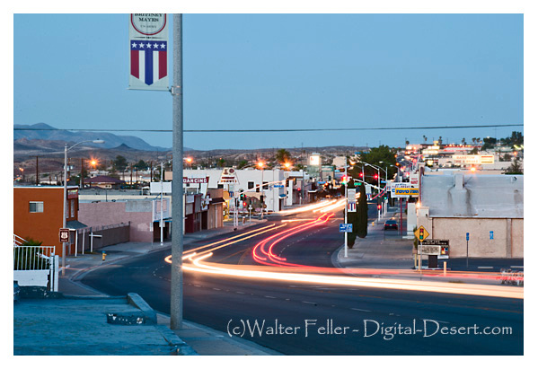
Named for William Barstow Strong, the 10th president of the Santa Fe Railroad
History of Barstow, California
Barstow, California, has a rich history that dates back to the late 19th century.Early Inhabitants:
Before European settlers arrived, the Barstow area was inhabited by Native American tribes, including the Vanyume people. These tribes had a rich cultural history in the region.
Railroad Development:
Barstow's history is closely tied to the development of the railroad. In the late 19th century, the Atchison, Topeka, and Santa Fe Railway (ATSF) played a crucial role in the city's growth. Barstow became a major railroad center and a division point for the ATSF.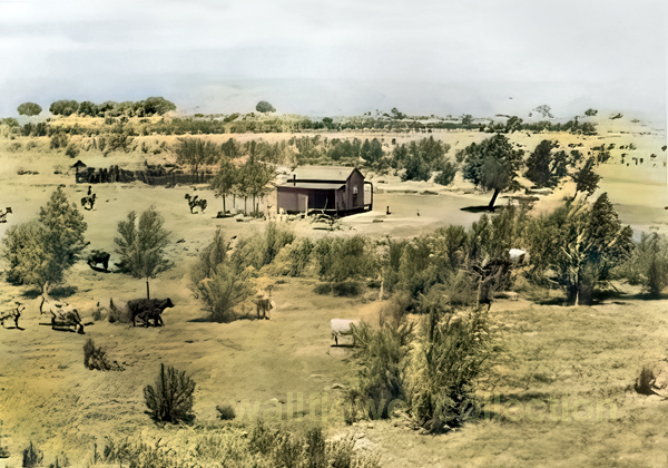
Waterman Ranch - circa 1884
Establishment of Barstow:
The town of Barstow was officially established in 1886. It was named after William Barstow Strong, then-president of the Atchison, Topeka, and Santa Fe Railway.
Route 66:
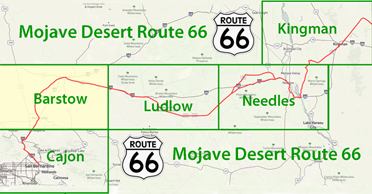
Barstow gained further importance in the early 20th century with the establishment of Route 66, the famous "Main Street of America." The city became a popular stop for travelers along this iconic highway, boosting its economic development.Military Presence:
During World War II, Barstow played a role in supporting the war effort. The nearby Marine Corps Logistics Base Barstow was established in 1942 to provide logistical support for the Marine Corps.Economic Development:
Barstow's economy has historically been linked to transportation and logistics, thanks to its strategic location along major transportation routes. The city has served as a transportation hub for the movement of goods and people.Railroad Decline:
While the railroad industry was instrumental in Barstow's early growth, the decline of the railroads in the latter half of the 20th century had an impact on the local economy. However, the city has adapted and diversified its economic base over the years.Tourism and Landmarks:
Barstow remains a popular stop for travelers, particularly due to its location at the junction of Interstates 15 and 40. The city is home to several landmarks, including the historic Harvey House Railroad Depot, now the Barstow Harvey House, which serves as a museum and visitor center.
Cultural and Historical Preservation:
Efforts have been made to preserve Barstow's historical and cultural heritage. The Route 66 "Mother Road" Museum, located in Barstow, celebrates the history of the iconic highway and its impact on the region. Overall, Barstow's history reflects the interconnectedness of transportation, economic development, and the changing landscape of the American West over the past century.Barstow Weather
Waterman Mine
Another Beneme Rancheria
Barstow Area Attractions
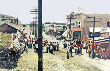
Heritage of the Mojave River Valley
Moving Barstow
Historic Barstow Photos
Freeways & Highways
About Barstow CaliforniaIncorporated 1947
Population - 31,273
Square Miles - 36
Barstow 1890
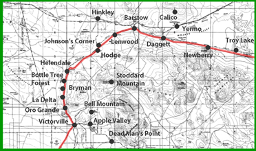
Barstow is situated at the junction of the California Southern and the A. &. P. Railway, eighty-two miles from San Bernardino and twelve miles from Daggett. It has an elevation of 1,900 feet. The population is about 300. The town is comparatively new. The climate is dry and clear with no fogs or dampness. There is a postoffice, telegraph, telephone and express offices, and daily stage for Calico, connecting with trains, as well as several stores carrying general merchandise, and a large railroad hotel. A silver mine and mill are to be found just north of this place.Barstow is situated at the junction of the California Southern and the A. &. P. Railway, eighty-two miles from San Bernardino and twelve miles from Daggett. It has an elevation of 1,900 feet. The population is about 300. The town is comparatively new. The climate is dry and clear with no fogs or dampness. There is a postoffice, telegraph, telephone and express offices, and daily stage for Calico, connecting with trains, as well as several stores carrying general merchandise, and a large railroad hotel. A silver mine and mill are to be found just north of this place.
History of Southern California
Lewis Publishing