Dawson Saddle
Dawson Saddle is a 7,903' saddle between 9,138' Throop Peak on the south and 8,396' Mt. Lewis on the north. The orientation of this saddle is unusual for these mountains in that it is a gap between two mountains on a north-trending ridge, and hence the drainage on all sides of the saddle goes to Big Rock Creek, thence to the Mojave Desert.The Angeles Crest Highway reaches its highest elevation at Dawson Saddle. What that elevation might actually be, however, is a bit of a mystery! The USGS gives 7,903' on the topo map and with their Geographic Names Information System - Dawson Saddle. The road sign gives 7,901'. But the difference of 2' is negligible compared to the 7,986' given by Robinson in The San Gabriels! That doesn't seem to be a typo since Robinson also says that during the construction of the highway, some wanted to add 14' of dirt fill so the sign could say an even 8,000'. We would appreciate enlightenment about this controversy if you have more information, and have taken the USGS number as the most authoritative.
Dawson Saddle has a trailhead parking lot and viewpoint overlooking Pinyon Ridge near the eastern end of the San Gabriel Mountains, 46 miles from I-210 in La Cañada and 10 miles west of Big Pines along SR2, the Angeles Crest Highway.
Dawson Saddle and Dawson Peak are both named for Ernest Dawson, the President of the Sierra Club in the mid-1930s, and owner of Dawson's Book Shop, the oldest continuously operating bookstore in the city of Los Angeles, since 1905. (Southern Sierran, August 1999, p. 6)
Access
Map: Mt. Islip Region (DS marks the location, in the center of the map)
See also: USGS 7.5' x 7.5' Map: Crystal Lake (34° 22' 04" N, 117° 48' 09" W)
By Car: From Interstate 210, go northeast on Angeles Crest Highway, State Route 2, 46 miles, about one hour 10 minutes driving time, to mile marker 69.6. A Forest Adventure Pass is needed for parking. The Lodgepole and Whitethorn Picnic Areas to the east that appear on some maps have been dismantled as of October 1999.
By Trail: South from the Dawson Saddle Trail that connects to the PCT near Throop Peak and north from an unmaintained trail up Mt. Lewis.
Season: Open May to November or whenever SR2 is not closed by snow.
Hikes
Warning: this list does not get updated as often as the hikes listed in the region tables. Consult Mt. Islip Region Hikes for the latest listing.
No. RT miles Elev. gain Season Name
80.1 9.2 (1 way) +2400-3700 jun-oct Dawson Saddle to Vincent Gap
80.2 1 500 may-nov Dawson Saddle to Mt. Lewis
81 8 2800 jun-oct Vincent Gap to Mt. Baden-Powell
Source: J. Strong & T. Chester
Hiking Trails
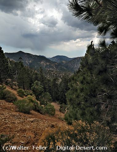
View southwest from Dawson Saddle
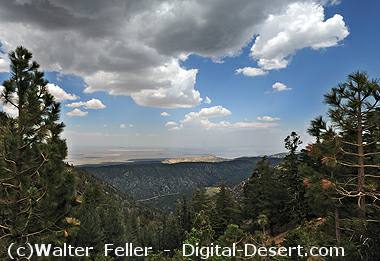
Looking across the Mojave Desert from Dawson Saddle
|