-.-
San Bernardino Mountains
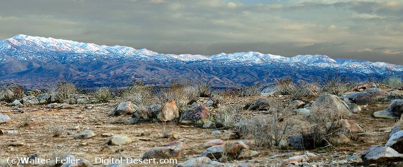
SAN BERNARDINO MOUNTAINSThe San Bernardino Mountains form the primary headwater region of the Mojave River system and are the dominant source of precipitation within the watershed. Although they comprise less than 5 percent of the total drainage basin area, they account for more than 95 percent of the total basin precipitation.GEOGRAPHIC AND HYDROLOGIC ROLERising above the surrounding desert, the mountains intercept moisture from regional storm systems, producing both rainfall and snow. This precipitation generates the runoff that feeds the Mojave River and its principal tributaries, including Deep Creek and the West Fork.Water from these high elevations flows through a network of streams and canyons, eventually converging to form the Mojave River at its headwater confluence. The river system is therefore dependent on this relatively small but climatically significant mountainous region. TECTONIC DEVELOPMENTThe San Bernardino Mountains are part of the active tectonic system associated with the San Andreas fault. Their uplift has played a decisive role in shaping regional drainage patterns.Between approximately 2.5 and 2 million years ago, continued uplift of the San Bernardino Range altered regional topography and reversed the direction of drainage. Prior to this period, water flowed toward the Pacific Ocean. After uplift, drainage was redirected inland, leading to the development of the Mojave River system and its internal basins. SIGNIFICANCEThe San Bernardino Mountains are essential to both the hydrology and geologic evolution of the Mojave River. They provide nearly all of the system's water while also having driven the tectonic changes that established its present drainage pattern.Their disproportionate contribution of precipitation underscores the dependence of the Mojave Desert river system on a limited but highly productive headwater source. < Previous <> Next > Eco-subsections: Upper San Gorgonio Mountains... the higher elevations and cooler parts of the San Bernardino Mountains. ...San Gorgonio Mountains... the lower and warmer parts of the San Bernardino Mountains, which are between the ...http://geomaps.wr.usgs.gov/socal/geology/transverse_ranges/index.html |
clickable map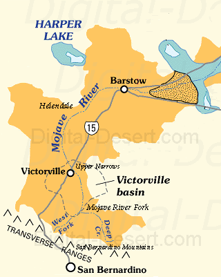
|