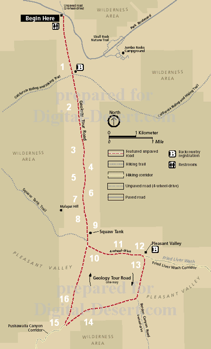
Digital-Desert : Mojave Desert Visit us on Facebook -- Desert Gazette -- Desert Link
Intro:: Nature:: Map:: Points of Interest:: Roads & Trails:: People & History:: Ghosts & Gold:: Communities:: BLOG:: Weather:: :?:: glossary

Joshua Tree National Park - Mojave Ecozone:
Geology Tour Road:

Stop #16

Panoramic View

In this tour of the Queen and Pleasant Valley's, we've seen rock records dating back nearly two billion years. Mountain building over at least two separate and distinct periods, examples of different type of erosion and indication of how, and why man survived in the desert. With the active San Andreas fault to the south, and minor faults such as the Blue Cut, the scenery here is dynamic and subject to change -- Exactly how it will change though, can only be left to speculation.

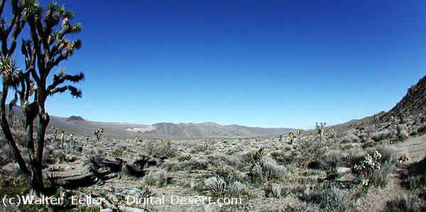
Wide-angle view of Pleasant Valley

PREVIOUS - NEXT

GLOSSARY > erosion, fault
Clickable map


Intro:: Nature:: Map:: Points of Interest:: Roads & Trails:: People & History:: Ghosts & Gold:: Communities:: BLOG:: Weather:: :?:: glossary
Country Life Realty
Wrightwood, Ca.
Mountain Hardware
Wrightwood, Ca.
Canyon Cartography
DesertLink
Links to Desert Museums

Grizzly Cafe
Family Dining


Custom Search

AbeBooks
Abraxas Engineering
privacy
These items are historical in scope and are intended for educational purposes only; they are not meant as an aid for travel planning.
Copyright ©Walter Feller. 1995-2023 - All rights reserved.