West Cronise Dry Lake
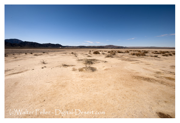
West Cronise Dry Lake is one of two large dry lakebeds (the other being East Cronise Dry Lake) located in the Mojave Desert of San Bernardino County, California. They sit just north of Interstate 15 between Baker and Barstow, not far from the Soda Mountains and the Mojave Rivers ancient path.
These playas are remnants of the Ice Age Lake Mojave system, which once held significant water fed by the Mojave River during wetter climates. Around 10,00015,000 years ago, this entire basin was filled with water, forming a series of lakes that included Soda Lake, Silver Lake, and the Cronise lakes. As the climate warmed and dried, the lakes evaporated, leaving the salt flats and dry basins seen today.
West Cronise Dry Lake is slightly smaller than East Cronise and is used today mainly for off-highway vehicle (OHV) recreation, desert exploration, and occasionally as a military training site due to its proximity to Fort Irwin. The flat, hard playa surface makes it attractive for vehicle travel, though dust storms and extreme temperatures are common. Wildlife in the surrounding areas includes desert tortoise, jackrabbits, coyotes, and a variety of lizards and snakes, though the lakebed itself is barren.
Historically, the Cronise lakes were important stops along the Mojave Road, the historic wagon route connecting the Colorado River to Southern California. Travelers and mail carriers often crossed these playas, relying on springs and scarce water sources in the surrounding desert. Today, the lakes are part of the Mojave National Preserves greater landscape, though they sit just outside its official boundaries.
Pleistocene Epoch (about 15,00010,000 years ago)
Part of the larger Lake Mojave system, filled by the Mojave River when climates were cooler and wetter.
Water spread across Silver, Soda, and Cronise basins, supporting early human habitation and Ice Age wildlife.
Holocene Epoch (after 10,000 years ago)
Climate warmed, rivers weakened, and the lakes dried into playas (dry lakebeds).
Evidence of shoreline terraces and deposits shows their former size and depth.
Prehistoric use (before European contact)
Native peoples, including the Mojave and Chemehuevi, traveled through the area, relying on springs and seasonal water.
The playas formed part of the route between water sources along what later became the Mojave Road.
Late 1700s1800s
Spanish explorers and later American trappers crossed the desert near the Cronise lakes.
Mid-1800s: The Mojave Road, a major wagon and mail route, passed by the lakes, though travelers had to plan carefully due to the lack of water.
1850s1870s
U.S. Army expeditions and mail carriers regularly used the route past the Cronise lakes.
The area gained a reputation for being one of the hardest stretches of the desert crossing.
1900s
The lakes remained dry basins but became better known with the growth of roads and later rail and highway travel through the Mojave.
Nearby Soda and Silver lakes saw some salt-mining interest, but Cronise remained largely untouched.
MidLate 20th century
Interstate 15 was built just south of the lakes, bringing travelers close by.
The flat surfaces attracted off-highway vehicle (OHV) use, desert explorers, and occasional military training from nearby Fort Irwin.
Present day
West and East Cronise are stark, barren playas but carry strong geological and historical significance as remnants of Lake Mojave.
They are part of the broader Mojave Desert cultural landscape tied to ancient lakes, early Native American use, and the historic Mojave Road.